

Radstrecke
A cycling route starting in Riedlingen, Baden-Wurttemberg, Germany.
Overview
About this route
Transition zone + start: Donaustadion Turn left over the Danube bridge, left along the Danube, left into Brühlweg, after the depot keep left to the airfield, after Fliegerhorst turn right, follow the road until Altheim is reached, turn left after the settler's farm, turn left again and then right, turn left onto the gravel path, over the Danube footbridge, turn right onto the embankment towards the feeding station, after the barn turn right towards Binzwangen, follow the road to the Spedition Martin Baur hall, -feeding station-, turn left into Im Bühl, continue to the bike path, there turn left until Ertingen is reached, turn left into the industrial area Albert-Einstein-Straße, follow the road, past the Erisdorf feeder, past the sports field and Neufra underpass, ride along Römerstraße, then turn left onto Kastanienallee, past the tennis hall continue straight, at the Kastanienallee/Hindenburgstr. intersection turn left, continue straight along Hindenburgstr. until the Rialto/Bäcker Böck, turn right into Haldenstr., at the intersection turn right into Mühltorstr., left onto Veitstr., left onto Zwiefalterstr., through the Zwiefalter Gate and past the Hotel Mohren Finish: Marktplatz
- -:--
- Duration
- 18.3 km
- Distance
- 15 m
- Ascent
- 7 m
- Descent
- ---
- Avg. speed
- 537 m
- Max. altitude
Route quality
Waytypes & surfaces along the route
Waytypes
Track
9 km
(49 %)
Access road
2.7 km
(15 %)
Surfaces
Paved
12.1 km
(66 %)
Unpaved
2.7 km
(15 %)
Asphalt
11.7 km
(64 %)
Loose gravel
2.6 km
(14 %)
Route highlights
Points of interest along the route
Point of interest after 0 km
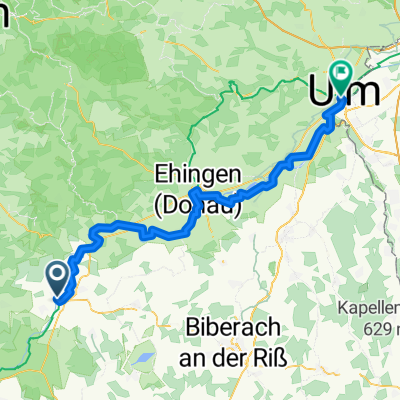
Wechselzone + Start, Donaustadion
Point of interest after 4.3 km
Verpflegungsstand, Donausteg
Point of interest after 8.9 km
Verpflegungsstand, Lagerhalle Spedition Martin Baur
Point of interest after 18.3 km
Ziel, Marktplatz
Continue with Bikemap
Use, edit, or download this cycling route
You would like to ride Radstrecke or customize it for your own trip? Here is what you can do with this Bikemap route:
Free features
- Save this route as favorite or in collections
- Copy & plan your own version of this route
- Sync your route with Garmin or Wahoo
Premium features
Free trial for 3 days, or one-time payment. More about Bikemap Premium.
- Navigate this route on iOS & Android
- Export a GPX / KML file of this route
- Create your custom printout (try it for free)
- Download this route for offline navigation
Discover more Premium features.
Get Bikemap PremiumFrom our community
Other popular routes starting in Riedlingen
 Nordic Walking
- Distance
- 9.8 km
- Ascent
- 39 m
- Descent
- 39 m
- Location
- Riedlingen, Baden-Wurttemberg, Germany
 Radstrecke
- Distance
- 18.3 km
- Ascent
- 15 m
- Descent
- 7 m
- Location
- Riedlingen, Baden-Wurttemberg, Germany
 Emeringen Unterwilzingen Mundingen Hausen
- Distance
- 53.9 km
- Ascent
- 478 m
- Descent
- 478 m
- Location
- Riedlingen, Baden-Wurttemberg, Germany
 Kreuztal Beuren Donauradweg
- Distance
- 33.5 km
- Ascent
- 157 m
- Descent
- 158 m
- Location
- Riedlingen, Baden-Wurttemberg, Germany
 5. Etappe_Riedlingen-Ulm_20.07.2025
- Distance
- 72.7 km
- Ascent
- 403 m
- Descent
- 455 m
- Location
- Riedlingen, Baden-Wurttemberg, Germany
 Hayingen Gomadingen Engstingen Pistre
- Distance
- 101.4 km
- Ascent
- 1,302 m
- Descent
- 1,154 m
- Location
- Riedlingen, Baden-Wurttemberg, Germany
 rund um die Schupfenberge
- Distance
- 57.3 km
- Ascent
- 407 m
- Descent
- 394 m
- Location
- Riedlingen, Baden-Wurttemberg, Germany
 Bussen Hayingen Hochberg Mörsingen
- Distance
- 60.7 km
- Ascent
- 926 m
- Descent
- 864 m
- Location
- Riedlingen, Baden-Wurttemberg, Germany
Open it in the app