

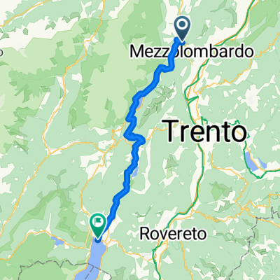
Giro delle Dolomiti del Brenta
A cycling route starting in Spormaggiore, Trentino-Alto Adige, Italy.
Overview
About this route
Il “Giro delle Dolomiti di Brenta” è uno degli itinerari di ciclismo su strada più classici del Trentino ed è secondo per blasone solo al celeberrimo “Giro dei Passi” (Sellaronda) che però è più breve e ciclisticamente meno impegnativo. Il giro alterna sezioni di “fondovalle”, saliscendi da rapporto, ciclabili e salite vere da scalatori, tuttavia mai troppo ripide. Il contesto ambientale del percorso è davvero grandioso. Il Gruppo Dolomitico del Brenta funge da perno attorno al quale si sviluppa l’anello
- -:--
- Duration
- 136 km
- Distance
- 2,175 m
- Ascent
- 2,154 m
- Descent
- ---
- Avg. speed
- ---
- Avg. speed

Route quality
Waytypes & surfaces along the route
Waytypes
Busy road
81.8 km
(60 %)
Quiet road
19.8 km
(15 %)
Surfaces
Paved
92.1 km
(68 %)
Unpaved
0.5 km
(<1 %)
Asphalt
88.9 km
(65 %)
Paved (undefined)
2.2 km
(2 %)
Continue with Bikemap
Use, edit, or download this cycling route
You would like to ride Giro delle Dolomiti del Brenta or customize it for your own trip? Here is what you can do with this Bikemap route:
Free features
- Save this route as favorite or in collections
- Copy & plan your own version of this route
- Sync your route with Garmin or Wahoo
Premium features
Free trial for 3 days, or one-time payment. More about Bikemap Premium.
- Navigate this route on iOS & Android
- Export a GPX / KML file of this route
- Create your custom printout (try it for free)
- Download this route for offline navigation
Discover more Premium features.
Get Bikemap PremiumFrom our community
Other popular routes starting in Spormaggiore
 Mezzocorona-Andalo-Molveno-Sarche
- Distance
- 97.4 km
- Ascent
- 2,930 m
- Descent
- 2,947 m
- Location
- Spormaggiore, Trentino-Alto Adige, Italy
 RIVAdo
- Distance
- 55.8 km
- Ascent
- 852 m
- Descent
- 1,446 m
- Location
- Spormaggiore, Trentino-Alto Adige, Italy
 Alpy 2014 (3) - Madonna di Campiglio
- Distance
- 132.2 km
- Ascent
- 2,149 m
- Descent
- 2,089 m
- Location
- Spormaggiore, Trentino-Alto Adige, Italy
 La Roccheta-Andola-Molveno-Ballino-Varone
- Distance
- 63.6 km
- Ascent
- 1,168 m
- Descent
- 1,289 m
- Location
- Spormaggiore, Trentino-Alto Adige, Italy
 Giro delle Dolomiti del Brenta AO
- Distance
- 132.5 km
- Ascent
- 3,559 m
- Descent
- 3,532 m
- Location
- Spormaggiore, Trentino-Alto Adige, Italy
 20150820_090103.gpx
- Distance
- 65.1 km
- Ascent
- 945 m
- Descent
- 1,142 m
- Location
- Spormaggiore, Trentino-Alto Adige, Italy
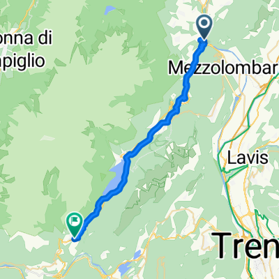 Mezzolombardo-San Lorenzo in Banale
- Distance
- 27.4 km
- Ascent
- 844 m
- Descent
- 420 m
- Location
- Spormaggiore, Trentino-Alto Adige, Italy
 2015-06-29 TRANSALP DAY 5
- Distance
- 73.5 km
- Ascent
- 895 m
- Descent
- 1,286 m
- Location
- Spormaggiore, Trentino-Alto Adige, Italy
Open it in the app