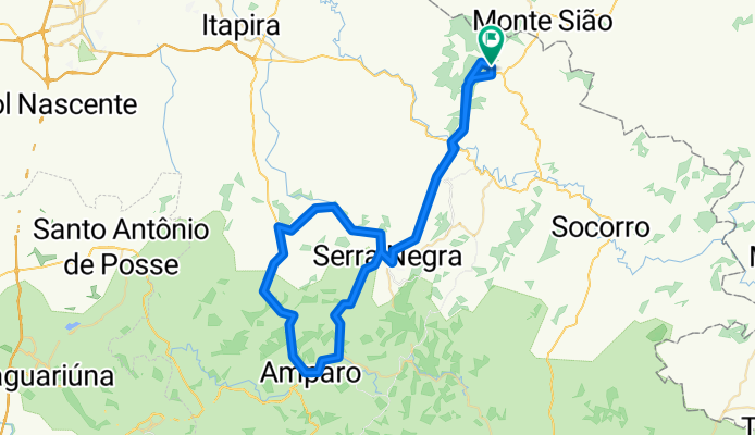
Premium Badge Download on the App Store Get it on Google Play Turn-by-turn Navigation Offline Maps Bike Type Optimized Routing Premium Maps Custom Bike Computer Export Routes Route Previews Fall Detection Premium Support

Cycling Route in 脕guas de Lind贸ia, S茫o Paulo, Brazil

Aguas-Lindoia_SerraNegra-Amparo-Lindoia

1
Open this route in the Bikemap app

Open this route in the Bikemap app

Open this route in Bikemap Web

Open this route in Bikemap Web

96 km
Distance
1355 m
Ascent
1360 m
Descent
-:-- h
Duration
-- km/h
Avg. Speed
--- m
Max. Elevation

About This Route

Serra Negra 20k; Amparo 39k; Serra Negra 73k; LInd贸ia 85k; 3129m de altimetria

This cycling route is ideal for: MTB

You will cycle on the following surfaces: Paved

Customize this cycling route with the Bikemap route planner.

Make it yours!

Did you know? You can use this route as a template in our cycling route planner if you don't wish to start from scratch. Customize it based on your needs to plan your perfect cycling tour.

Open it in the app