

Ringelai-Passau-Hengersberg-Tittling-Ringelai
A cycling route starting in Ringelai, Bavaria, Germany.
Overview
About this route
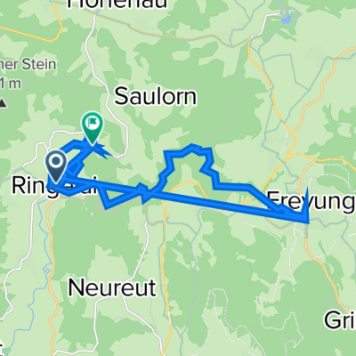
Von Ringelai über Nebenstraßen nach Passau. Am Donauradweg über Vilshofen und HOfkirchen bis nach Hengersberg und dann auf dem Bayerwald Radweg nach Tittling und von dort über Haus i. Wald auf Nebenstraßen zurück nach Ringelai
- -:--
- Duration
- 120 km
- Distance
- 871 m
- Ascent
- 871 m
- Descent
- ---
- Avg. speed
- ---
- Avg. speed
Route quality
Waytypes & surfaces along the route
Waytypes
Path
39.8 km
(33 %)
Road
27.2 km
(23 %)
Surfaces
Paved
76.3 km
(64 %)
Unpaved
7.9 km
(7 %)
Asphalt
76 km
(63 %)
Loose gravel
5.2 km
(4 %)
Continue with Bikemap
Use, edit, or download this cycling route
You would like to ride Ringelai-Passau-Hengersberg-Tittling-Ringelai or customize it for your own trip? Here is what you can do with this Bikemap route:
Free features
- Save this route as favorite or in collections
- Copy & plan your own version of this route
- Sync your route with Garmin or Wahoo
Premium features
Free trial for 3 days, or one-time payment. More about Bikemap Premium.
- Navigate this route on iOS & Android
- Export a GPX / KML file of this route
- Create your custom printout (try it for free)
- Download this route for offline navigation
Discover more Premium features.
Get Bikemap PremiumFrom our community
Other popular routes starting in Ringelai
 Pfarrer-Kainz-Straße 5, Ringelai nach FRG34 11, Ringelai
- Distance
- 35.9 km
- Ascent
- 482 m
- Descent
- 393 m
- Location
- Ringelai, Bavaria, Germany
 Von Freyung zum Geistlichen Stein
- Distance
- 34.7 km
- Ascent
- 739 m
- Descent
- 739 m
- Location
- Ringelai, Bavaria, Germany
 Ringelai-Fuschlsee
- Distance
- 159.1 km
- Ascent
- 844 m
- Descent
- 726 m
- Location
- Ringelai, Bavaria, Germany
 Ringelai - Nationalparkstraße - Freyung
- Distance
- 53 km
- Ascent
- 1,231 m
- Descent
- 1,231 m
- Location
- Ringelai, Bavaria, Germany
 Regen-Zwiesel
- Distance
- 100.2 km
- Ascent
- 1,069 m
- Descent
- 1,069 m
- Location
- Ringelai, Bavaria, Germany
 Ringelai
- Distance
- 20.6 km
- Ascent
- 518 m
- Descent
- 522 m
- Location
- Ringelai, Bavaria, Germany
 Entspannende Route in Röhrnbach
- Distance
- 28.4 km
- Ascent
- 1,049 m
- Descent
- 967 m
- Location
- Ringelai, Bavaria, Germany
 Ringelai-Passau-Hengersberg-Tittling-Ringelai
- Distance
- 120 km
- Ascent
- 871 m
- Descent
- 871 m
- Location
- Ringelai, Bavaria, Germany
Open it in the app