
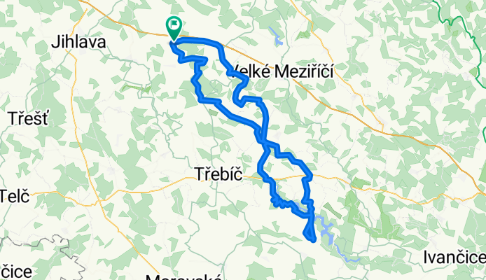
cyklo vylet na dalešickou přehradu
A cycling route starting in Kamenice, Kraj Vysočina, Czechia.
Overview
About this route
vylet na dalešickou přehradu
(cloned from route 3101544)
- -:--
- Duration
- 111.7 km
- Distance
- 793 m
- Ascent
- 786 m
- Descent
- ---
- Avg. speed
- ---
- Avg. speed
Route quality
Waytypes & surfaces along the route
Waytypes
Road
32.5 km
(29 %)
Busy road
30.7 km
(27 %)
Surfaces
Paved
5 km
(4 %)
Unpaved
24.4 km
(22 %)
Unpaved (undefined)
11.7 km
(10 %)
Ground
9.5 km
(9 %)
Continue with Bikemap
Use, edit, or download this cycling route
You would like to ride cyklo vylet na dalešickou přehradu or customize it for your own trip? Here is what you can do with this Bikemap route:
Free features
- Save this route as favorite or in collections
- Copy & plan your own version of this route
- Sync your route with Garmin or Wahoo
Premium features
Free trial for 3 days, or one-time payment. More about Bikemap Premium.
- Navigate this route on iOS & Android
- Export a GPX / KML file of this route
- Create your custom printout (try it for free)
- Download this route for offline navigation
Discover more Premium features.
Get Bikemap PremiumFrom our community
Other popular routes starting in Kamenice
 rehororv-dedkova hora-arnolecke hory-rehorov
- Distance
- 33.5 km
- Ascent
- 404 m
- Descent
- 404 m
- Location
- Kamenice, Kraj Vysočina, Czechia
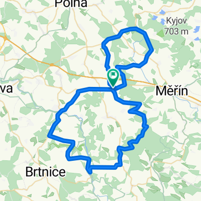 rehorov-luka nad jihlavou-kouty-staj-rehorov
- Distance
- 65.8 km
- Ascent
- 733 m
- Descent
- 733 m
- Location
- Kamenice, Kraj Vysočina, Czechia
 rehorov-mostiste-baliny-rehorov
- Distance
- 62.6 km
- Ascent
- 601 m
- Descent
- 563 m
- Location
- Kamenice, Kraj Vysočina, Czechia
 REHOROV-VELKE MEZIRIC-TASOV-RUDIKOV-REHOROV
- Distance
- 73.4 km
- Ascent
- 502 m
- Descent
- 502 m
- Location
- Kamenice, Kraj Vysočina, Czechia
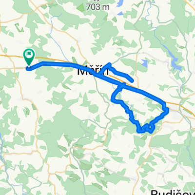 rehorov-balinske udoli - rehorov
- Distance
- 52.7 km
- Ascent
- 362 m
- Descent
- 362 m
- Location
- Kamenice, Kraj Vysočina, Czechia
 cyklo vylet na dalešickou přehradu
- Distance
- 111.7 km
- Ascent
- 793 m
- Descent
- 786 m
- Location
- Kamenice, Kraj Vysočina, Czechia
 rehorov -horni radslavice-staj-rehorov
- Distance
- 55.9 km
- Ascent
- 541 m
- Descent
- 541 m
- Location
- Kamenice, Kraj Vysočina, Czechia
 rehorov-mostiste-merin-pavlinov-mostiste-dedkova hora-rehorov
- Distance
- 96.3 km
- Ascent
- 807 m
- Descent
- 807 m
- Location
- Kamenice, Kraj Vysočina, Czechia
Open it in the app