

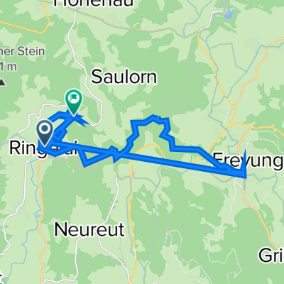
Ringelai - Nationalparkstraße - Freyung
A cycling route starting in Ringelai, Bavaria, Germany.
Overview
About this route
Ringelai - Hohenau - Maut - Philippsreut-Herzogsreut-Freyung-ringelai
- -:--
- Duration
- 53 km
- Distance
- 1,231 m
- Ascent
- 1,231 m
- Descent
- ---
- Avg. speed
- ---
- Avg. speed
Route quality
Waytypes & surfaces along the route
Waytypes
Road
31.5 km
(59 %)
Quiet road
7.8 km
(15 %)
Surfaces
Paved
26.2 km
(49 %)
Unpaved
6.1 km
(11 %)
Asphalt
25.4 km
(48 %)
Gravel
3.2 km
(6 %)
Continue with Bikemap
Use, edit, or download this cycling route
You would like to ride Ringelai - Nationalparkstraße - Freyung or customize it for your own trip? Here is what you can do with this Bikemap route:
Free features
- Save this route as favorite or in collections
- Copy & plan your own version of this route
- Sync your route with Garmin or Wahoo
Premium features
Free trial for 3 days, or one-time payment. More about Bikemap Premium.
- Navigate this route on iOS & Android
- Export a GPX / KML file of this route
- Create your custom printout (try it for free)
- Download this route for offline navigation
Discover more Premium features.
Get Bikemap PremiumFrom our community
Other popular routes starting in Ringelai
 Ringelai-Passau-Hengersberg-Tittling-Ringelai
- Distance
- 120 km
- Ascent
- 871 m
- Descent
- 871 m
- Location
- Ringelai, Bavaria, Germany
 Ringelai - Nationalparkstraße - Freyung
- Distance
- 53 km
- Ascent
- 1,231 m
- Descent
- 1,231 m
- Location
- Ringelai, Bavaria, Germany
 Ringelai
- Distance
- 20.6 km
- Ascent
- 518 m
- Descent
- 522 m
- Location
- Ringelai, Bavaria, Germany
 Pfarrer-Kainz-Straße 5, Ringelai nach FRG34 11, Ringelai
- Distance
- 35.9 km
- Ascent
- 482 m
- Descent
- 393 m
- Location
- Ringelai, Bavaria, Germany
 Perlesreuter Straße 19, Ringelai nach St2323 24, Ruderting
- Distance
- 26.2 km
- Ascent
- 924 m
- Descent
- 893 m
- Location
- Ringelai, Bavaria, Germany
 Von Freyung zum Geistlichen Stein
- Distance
- 34.7 km
- Ascent
- 739 m
- Descent
- 739 m
- Location
- Ringelai, Bavaria, Germany
 Ringelai Radfahren
- Distance
- 3.5 km
- Ascent
- 103 m
- Descent
- 109 m
- Location
- Ringelai, Bavaria, Germany
 Ringelai-Fuschlsee
- Distance
- 159.1 km
- Ascent
- 844 m
- Descent
- 726 m
- Location
- Ringelai, Bavaria, Germany
Open it in the app