
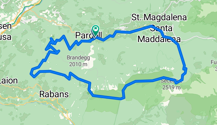
Gufidaun
A cycling route starting in Funes - Villnoess, Trentino-Alto Adige, Italy.
Overview
About this route
Mountainbike-Tour in Südtirol
(cloned from route 2328598)
- -:--
- Duration
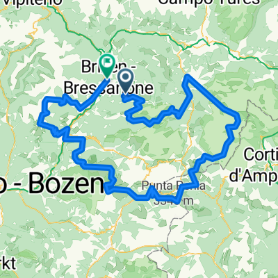
- 36.6 km
- Distance
- 1,413 m
- Ascent
- 1,414 m
- Descent
- ---
- Avg. speed
- ---
- Avg. speed
Continue with Bikemap
Use, edit, or download this cycling route
You would like to ride Gufidaun or customize it for your own trip? Here is what you can do with this Bikemap route:
Free features
- Save this route as favorite or in collections
- Copy & plan your own version of this route
- Sync your route with Garmin or Wahoo
Premium features
Free trial for 3 days, or one-time payment. More about Bikemap Premium.
- Navigate this route on iOS & Android
- Export a GPX / KML file of this route
- Create your custom printout (try it for free)
- Download this route for offline navigation
Discover more Premium features.
Get Bikemap PremiumFrom our community
Other popular routes starting in Funes - Villnoess
 Bike testival 2011 Felt Enduro
- Distance
- 17.5 km
- Ascent
- 68 m
- Descent
- 1,547 m
- Location
- Funes - Villnoess, Trentino-Alto Adige, Italy
 Bike testival 2011 Felt Enduro
- Distance
- 17.5 km
- Ascent
- 100 m
- Descent
- 1,572 m
- Location
- Funes - Villnoess, Trentino-Alto Adige, Italy
 Villnöß Riva
- Distance
- 148.5 km
- Ascent
- 721 m
- Descent
- 1,687 m
- Location
- Funes - Villnoess, Trentino-Alto Adige, Italy
 Kirchfeld 1–2, Villnöß nach Sneton Strasse, Ortisei
- Distance
- 13.6 km
- Ascent
- 1,234 m
- Descent
- 1,158 m
- Location
- Funes - Villnoess, Trentino-Alto Adige, Italy
 ALPENCROSS 2 Tag 3 Variante 2
- Distance
- 147.5 km
- Ascent
- 1,963 m
- Descent
- 2,696 m
- Location
- Funes - Villnoess, Trentino-Alto Adige, Italy
 Pardell 23, Funes nach San Maddalena 107B, Santa Magdalena
- Distance
- 6.4 km
- Ascent
- 318 m
- Descent
- 28 m
- Location
- Funes - Villnoess, Trentino-Alto Adige, Italy
 Gufidaun
- Distance
- 36.6 km
- Ascent
- 1,413 m
- Descent
- 1,414 m
- Location
- Funes - Villnoess, Trentino-Alto Adige, Italy
 mtb1
mtb1- Distance
- 213.4 km
- Ascent
- 6,047 m
- Descent
- 7,503 m
- Location
- Funes - Villnoess, Trentino-Alto Adige, Italy
Open it in the app