
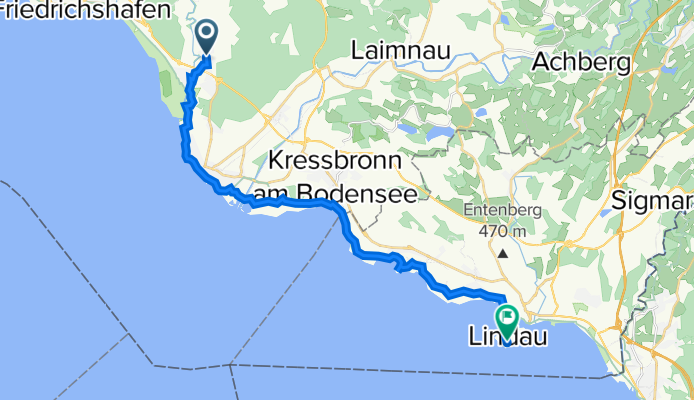
Eriskirch-Lindau
A cycling route starting in Eriskirch, Baden-Württemberg, Germany.
Overview
About this route
Bodenseetour
- -:--
- Duration
- 21.1 km
- Distance
- 16 m
- Ascent
- 22 m
- Descent
- ---
- Avg. speed
- ---
- Avg. speed
Route quality
Waytypes & surfaces along the route
Waytypes
Quiet road
12.8 km
(60 %)
Path
2.8 km
(13 %)
Surfaces
Paved
19.3 km
(91 %)
Unpaved
1.2 km
(6 %)
Asphalt
18.9 km
(90 %)
Loose gravel
1 km
(5 %)
Continue with Bikemap
Use, edit, or download this cycling route
You would like to ride Eriskirch-Lindau or customize it for your own trip? Here is what you can do with this Bikemap route:
Free features
- Save this route as favorite or in collections
- Copy & plan your own version of this route
- Sync your route with Garmin or Wahoo
Premium features
Free trial for 3 days, or one-time payment. More about Bikemap Premium.
- Navigate this route on iOS & Android
- Export a GPX / KML file of this route
- Create your custom printout (try it for free)
- Download this route for offline navigation
Discover more Premium features.
Get Bikemap PremiumFrom our community
Other popular routes starting in Eriskirch
 Hinterland
- Distance
- 45.5 km
- Ascent
- 403 m
- Descent
- 383 m
- Location
- Eriskirch, Baden-Württemberg, Germany
 Obersee 2. Etappe
- Distance
- 76.1 km
- Ascent
- 132 m
- Descent
- 132 m
- Location
- Eriskirch, Baden-Württemberg, Germany
 Rund um Tettnang
- Distance
- 39.5 km
- Ascent
- 239 m
- Descent
- 242 m
- Location
- Eriskirch, Baden-Württemberg, Germany
 Bodensee Etappe 1
- Distance
- 95.8 km
- Ascent
- 92 m
- Descent
- 93 m
- Location
- Eriskirch, Baden-Württemberg, Germany
 Obersee 1
- Distance
- 90.3 km
- Ascent
- 101 m
- Descent
- 101 m
- Location
- Eriskirch, Baden-Württemberg, Germany
 Mariabrunn-Oberteuringen
- Distance
- 17.7 km
- Ascent
- 107 m
- Descent
- 63 m
- Location
- Eriskirch, Baden-Württemberg, Germany
 Friedrichshafen-Sonthofen
- Distance
- 91.7 km
- Ascent
- 1,714 m
- Descent
- 1,309 m
- Location
- Eriskirch, Baden-Württemberg, Germany
 Rotach
- Distance
- 27.2 km
- Ascent
- 49 m
- Descent
- 48 m
- Location
- Eriskirch, Baden-Württemberg, Germany
Open it in the app