

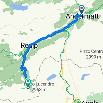
Göschenen-Flüelen
A cycling route starting in Andermatt, Canton of Uri, Switzerland.
Overview
About this route
Zum Fotographieren an der Gotthard-Strecke
- -:--
- Duration
- 34.1 km
- Distance
- 298 m
- Ascent
- 975 m
- Descent
- ---
- Avg. speed
- 1,120 m
- Avg. speed

Route quality
Waytypes & surfaces along the route
Waytypes
Busy road
17.5 km
(51 %)
Quiet road
6.8 km
(20 %)
Surfaces
Paved
30.1 km
(88 %)
Unpaved
0.7 km
(2 %)
Asphalt
29.5 km
(87 %)
Paved (undefined)
0.4 km
(1 %)
Route highlights
Points of interest along the route

Point of interest after 3.6 km
Einfahrtin den untersten Tunnel von Wassen - Richtung Tessin

Point of interest after 4 km
Blick auf den Bahnhof Wassen

Point of interest after 4.2 km
Blick nach Erstfeld - Aprilwetter im Uri - Sonne im Rest der Schweiz

Point of interest after 4.7 km
Kirche Wassen

Point of interest after 6.1 km
Eisenbahn, Landstrasse, Reuss, Autobahn... Da war ein Haus zum Vermieten frei...
Continue with Bikemap
Use, edit, or download this cycling route
You would like to ride Göschenen-Flüelen or customize it for your own trip? Here is what you can do with this Bikemap route:
Free features
- Save this route as favorite or in collections
- Copy & plan your own version of this route
- Sync your route with Garmin or Wahoo
Premium features
Free trial for 3 days, or one-time payment. More about Bikemap Premium.
- Navigate this route on iOS & Android
- Export a GPX / KML file of this route
- Create your custom printout (try it for free)
- Download this route for offline navigation
Discover more Premium features.
Get Bikemap PremiumFrom our community
Other popular routes starting in Andermatt
 VR01 Furkapass Belvedere-Brig.kml - VR01 Furkapass Belvedere-Brig.kml_VR01 Furkapass Belvedere-Brig
- Distance
- 60.1 km
- Ascent
- 852 m
- Descent
- 2,409 m
- Location
- Andermatt, Canton of Uri, Switzerland
 giro dei tre passi susten grimsel furka
- Distance
- 132.9 km
- Ascent
- 3,457 m
- Descent
- 3,601 m
- Location
- Andermatt, Canton of Uri, Switzerland
 Witenwasseren Bike
- Distance
- 17.3 km
- Ascent
- 808 m
- Descent
- 26 m
- Location
- Andermatt, Canton of Uri, Switzerland
 Furka-Nufenen-Gotthard-Oberalp
- Distance
- 135.9 km
- Ascent
- 4,637 m
- Descent
- 4,527 m
- Location
- Andermatt, Canton of Uri, Switzerland
 Rhine Cycle Route - Switzerland
- Distance
- 492.2 km
- Ascent
- 6,424 m
- Descent
- 7,590 m
- Location
- Andermatt, Canton of Uri, Switzerland
![[DAY 19] Göschenen - Ilanz](https://media.bikemap.net/routes/8561780/gallery/thumbs/af10c4bc-a85d-4013-8c11-c6c25ccc528a.jpeg.208x208_q80_crop.jpg) [DAY 19] Göschenen - Ilanz
[DAY 19] Göschenen - Ilanz- Distance
- 68.1 km
- Ascent
- 984 m
- Descent
- 1,380 m
- Location
- Andermatt, Canton of Uri, Switzerland
 Reuss 1 bis Flüelen
- Distance
- 32.7 km
- Ascent
- 587 m
- Descent
- 1,287 m
- Location
- Andermatt, Canton of Uri, Switzerland
 NL The Rhine Cycle Route
- Distance
- 1,352.1 km
- Ascent
- 88 m
- Descent
- 1,523 m
- Location
- Andermatt, Canton of Uri, Switzerland
Open it in the app