

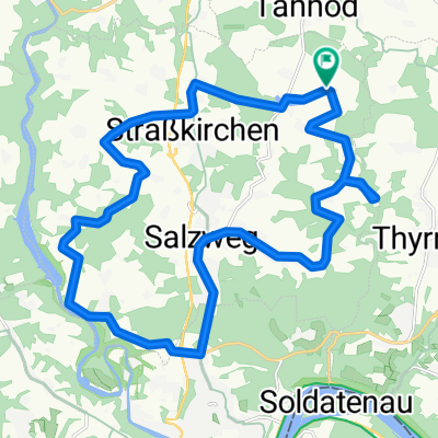
Straßkirchen_Oberfrauenwald_und_zurück
A cycling route starting in Witzmannsberg, Bavaria, Germany.
Overview
About this route
Durchs Staffelbachtal, am Freudensee vorbei nach Oberfrauenwald und wieder zurück nach Straßkirchen
- -:--
- Duration
- 61.7 km
- Distance
- 920 m
- Ascent
- 920 m
- Descent
- ---
- Avg. speed
- ---
- Avg. speed
Route quality
Waytypes & surfaces along the route
Waytypes
Quiet road
27.5 km
(45 %)
Track
19.4 km
(32 %)
Surfaces
Paved
26.5 km
(43 %)
Unpaved
13.3 km
(22 %)
Asphalt
22.7 km
(37 %)
Gravel
9.2 km
(15 %)
Continue with Bikemap
Use, edit, or download this cycling route
You would like to ride Straßkirchen_Oberfrauenwald_und_zurück or customize it for your own trip? Here is what you can do with this Bikemap route:
Free features
- Save this route as favorite or in collections
- Copy & plan your own version of this route
- Sync your route with Garmin or Wahoo
Premium features
Free trial for 3 days, or one-time payment. More about Bikemap Premium.
- Navigate this route on iOS & Android
- Export a GPX / KML file of this route
- Create your custom printout (try it for free)
- Download this route for offline navigation
Discover more Premium features.
Get Bikemap PremiumFrom our community
Other popular routes starting in Witzmannsberg
 Strkch-Perlesr-Graf-Ringlai-Prag-Strkch
- Distance
- 70 km
- Ascent
- 751 m
- Descent
- 751 m
- Location
- Witzmannsberg, Bavaria, Germany
 Straßkirchen_Oberfrauenwald_und_zurück
- Distance
- 61.7 km
- Ascent
- 920 m
- Descent
- 920 m
- Location
- Witzmannsberg, Bavaria, Germany
 Oberstrahbergmühle_Goggersreut_Rappmannsberg
- Distance
- 46.7 km
- Ascent
- 623 m
- Descent
- 630 m
- Location
- Witzmannsberg, Bavaria, Germany
 Gartenweg 19, Salzweg nach Gartenweg 21, Salzweg
- Distance
- 23.2 km
- Ascent
- 497 m
- Descent
- 496 m
- Location
- Witzmannsberg, Bavaria, Germany
 Nottauer_Höh
- Distance
- 38.4 km
- Ascent
- 534 m
- Descent
- 534 m
- Location
- Witzmannsberg, Bavaria, Germany
 Willhartsberg 2, Salzweg nach Zuppinger Straße 27–28, Freyung
- Distance
- 26 km
- Ascent
- 628 m
- Descent
- 444 m
- Location
- Witzmannsberg, Bavaria, Germany
 Oberilzmühle
- Distance
- 24.7 km
- Ascent
- 364 m
- Descent
- 375 m
- Location
- Witzmannsberg, Bavaria, Germany
 Ensmannsreut_Zimmermandling
- Distance
- 61.2 km
- Ascent
- 701 m
- Descent
- 701 m
- Location
- Witzmannsberg, Bavaria, Germany
Open it in the app