

Wein, Wald, 11, 12, und 13
A cycling route starting in Ellhofen, Baden-Württemberg, Germany.
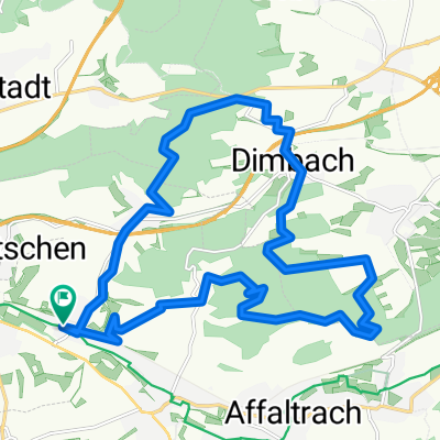
Overview
About this route
Die Route führt entlang der obersulmer Wanderwege 11, 12 und 13. Der Untergrund wechselt ständig, Asphaltierte Weinbergstraßen mit toller Aussicht und Wanderpfade im Wald wechseln sich ab. Es geht auch mal auf engen Waldwegen entlang. Im Sommer sind die Brennesseln besonders prickelnd;-)
Wer sich traut kann nördlich von Wimmental die 100 Meter lange Treppe abwärts nehmen. Die Stufen sind aus Holzbalken gemacht und mitunter sehr rutschig...kann aber auch umfahren werden.
- -:--
- Duration
- 20.1 km
- Distance
- 413 m
- Ascent
- 340 m
- Descent
- ---
- Avg. speed
- 314 m
- Avg. speed
Route quality
Waytypes & surfaces along the route
Waytypes
Track
13.5 km
(67 %)
Path
2.3 km
(11 %)
Surfaces
Paved
8.9 km
(44 %)
Unpaved
10.6 km
(53 %)
Asphalt
8.3 km
(41 %)
Gravel
5.8 km
(29 %)
Continue with Bikemap
Use, edit, or download this cycling route
You would like to ride Wein, Wald, 11, 12, und 13 or customize it for your own trip? Here is what you can do with this Bikemap route:
Free features
- Save this route as favorite or in collections
- Copy & plan your own version of this route
- Sync your route with Garmin or Wahoo
Premium features
Free trial for 3 days, or one-time payment. More about Bikemap Premium.
- Navigate this route on iOS & Android
- Export a GPX / KML file of this route
- Create your custom printout (try it for free)
- Download this route for offline navigation
Discover more Premium features.
Get Bikemap PremiumFrom our community
Other popular routes starting in Ellhofen
 Eulenbergstraße 60, Ellhofen nach Eulenbergstraße 60, Ellhofen
- Distance
- 17.1 km
- Ascent
- 281 m
- Descent
- 285 m
- Location
- Ellhofen, Baden-Württemberg, Germany
 Valalta
- Distance
- 840.6 km
- Ascent
- 3,685 m
- Descent
- 3,828 m
- Location
- Ellhofen, Baden-Württemberg, Germany
 Ellhofen - Waldheide - Reißbergbrücke - Waldheide - Weinsberg - Ellhofen
- Distance
- 20.3 km
- Ascent
- 296 m
- Descent
- 296 m
- Location
- Ellhofen, Baden-Württemberg, Germany
 Streuobsttour
- Distance
- 34.3 km
- Ascent
- 282 m
- Descent
- 282 m
- Location
- Ellhofen, Baden-Württemberg, Germany
 GRA rappach eschenau OSU GRA
- Distance
- 24.8 km
- Ascent
- 189 m
- Descent
- 190 m
- Location
- Ellhofen, Baden-Württemberg, Germany
 Frohnfalls ab Sülzbach über Adolzfurt - Gailsbach und zurück Ohrntal - Öhringen - Bretzfeld - Dimbach - Wimmental
- Distance
- 59.9 km
- Ascent
- 448 m
- Descent
- 448 m
- Location
- Ellhofen, Baden-Württemberg, Germany
 fahrt nach Vaihingen
- Distance
- 79.8 km
- Ascent
- 397 m
- Descent
- 408 m
- Location
- Ellhofen, Baden-Württemberg, Germany
 Wein, Wald, 11, 12, und 13
- Distance
- 20.1 km
- Ascent
- 413 m
- Descent
- 340 m
- Location
- Ellhofen, Baden-Württemberg, Germany
Open it in the app