

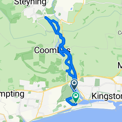
shorehambysea-nationalpark
A cycling route starting in Shoreham-by-Sea, England, United Kingdom.
Overview
About this route
shorehambysea-nationalpark
(cloned from route 3166594)
- -:--
- Duration
- 86.7 km
- Distance
- 795 m
- Ascent
- 792 m
- Descent
- ---
- Avg. speed
- ---
- Avg. speed
Route quality
Waytypes & surfaces along the route
Waytypes
Quiet road
26.2 km
(30 %)
Cycleway
22.2 km
(26 %)
Surfaces
Paved
35.4 km
(41 %)
Unpaved
21.8 km
(25 %)
Asphalt
35.3 km
(41 %)
Unpaved (undefined)
9 km
(10 %)
Continue with Bikemap
Use, edit, or download this cycling route
You would like to ride shorehambysea-nationalpark or customize it for your own trip? Here is what you can do with this Bikemap route:
Free features
- Save this route as favorite or in collections
- Copy & plan your own version of this route
- Sync your route with Garmin or Wahoo
Premium features
Free trial for 3 days, or one-time payment. More about Bikemap Premium.
- Navigate this route on iOS & Android
- Export a GPX / KML file of this route
- Create your custom printout (try it for free)
- Download this route for offline navigation
Discover more Premium features.
Get Bikemap PremiumFrom our community
Other popular routes starting in Shoreham-by-Sea
 shorehambysea-nationalpark
- Distance
- 86.7 km
- Ascent
- 795 m
- Descent
- 792 m
- Location
- Shoreham-by-Sea, England, United Kingdom
 Wolstonbury Walk 26 to East Street 7
- Distance
- 24 km
- Ascent
- 223 m
- Descent
- 236 m
- Location
- Shoreham-by-Sea, England, United Kingdom
 Bike Ride With Smokey
- Distance
- 16.5 km
- Ascent
- 9 m
- Descent
- 9 m
- Location
- Shoreham-by-Sea, England, United Kingdom
 Route to Fareham
- Distance
- 93.7 km
- Ascent
- 246 m
- Descent
- 210 m
- Location
- Shoreham-by-Sea, England, United Kingdom
 Steyning Line Explore
- Distance
- 56.7 km
- Ascent
- 278 m
- Descent
- 248 m
- Location
- Shoreham-by-Sea, England, United Kingdom
 Poslední švih v UK
- Distance
- 33.7 km
- Ascent
- 388 m
- Descent
- 391 m
- Location
- Shoreham-by-Sea, England, United Kingdom
 Downs Link (Brighton to Guildford)
- Distance
- 58.2 km
- Ascent
- 318 m
- Descent
- 184 m
- Location
- Shoreham-by-Sea, England, United Kingdom
 Shoreham a okolí
- Distance
- 19.2 km
- Ascent
- 236 m
- Descent
- 236 m
- Location
- Shoreham-by-Sea, England, United Kingdom
Open it in the app