

Hatzenport_Koblenz.gpx
A cycling route starting in Hatzenport, Rhineland-Palatinate, Germany.
Overview
About this route
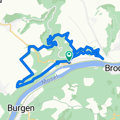
Tag 6 und die Rückkehr zum Ausgangspunkt nach Koblenz HBf ist in gut 2 Stunden erledigt. Als Schlusspunkt und Highlight das Deutsche Eck mit der Festung Ehrenbreitstein - beeindruckend...
- -:--
- Duration
- 31.5 km
- Distance
- 163 m
- Ascent
- 166 m
- Descent
- ---
- Avg. speed
- ---
- Avg. speed

Continue with Bikemap
Use, edit, or download this cycling route
You would like to ride Hatzenport_Koblenz.gpx or customize it for your own trip? Here is what you can do with this Bikemap route:
Free features
- Save this route as favorite or in collections
- Copy & plan your own version of this route
- Sync your route with Garmin or Wahoo
Premium features
Free trial for 3 days, or one-time payment. More about Bikemap Premium.
- Navigate this route on iOS & Android
- Export a GPX / KML file of this route
- Create your custom printout (try it for free)
- Download this route for offline navigation
Discover more Premium features.
Get Bikemap PremiumFrom our community
Other popular routes starting in Hatzenport
 Hatzenport_Koblenz.gpx
- Distance
- 31.5 km
- Ascent
- 163 m
- Descent
- 166 m
- Location
- Hatzenport, Rhineland-Palatinate, Germany
 Traumpfad Hatzenporter Laysteig
- Distance
- 11.9 km
- Ascent
- 408 m
- Descent
- 407 m
- Location
- Hatzenport, Rhineland-Palatinate, Germany
 E-Bike- Tour Eifelhöhen
- Distance
- 41.7 km
- Ascent
- 518 m
- Descent
- 513 m
- Location
- Hatzenport, Rhineland-Palatinate, Germany
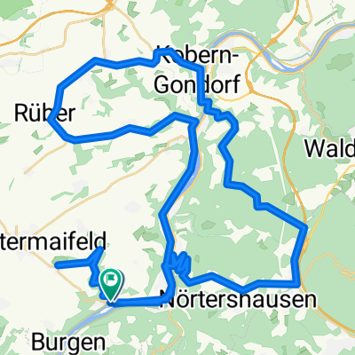
 Maifeld-Mosel-Runde
- Distance
- 39.8 km
- Ascent
- 488 m
- Descent
- 482 m
- Location
- Hatzenport, Rhineland-Palatinate, Germany
 moezel richting noordwest ingekort tot 53 km
- Distance
- 53.1 km
- Ascent
- 678 m
- Descent
- 687 m
- Location
- Hatzenport, Rhineland-Palatinate, Germany
 zuidoost moezel 64 km half langs hundsruck-mosel fietsroute
- Distance
- 64 km
- Ascent
- 665 m
- Descent
- 647 m
- Location
- Hatzenport, Rhineland-Palatinate, Germany
 tour über traumpfade nach laserg schrumpftal alken oberfell
- Distance
- 26.4 km
- Ascent
- 552 m
- Descent
- 542 m
- Location
- Hatzenport, Rhineland-Palatinate, Germany
 moseltour mit ein paar steigung und canyon strecke2
- Distance
- 60.2 km
- Ascent
- 756 m
- Descent
- 755 m
- Location
- Hatzenport, Rhineland-Palatinate, Germany
Open it in the app