

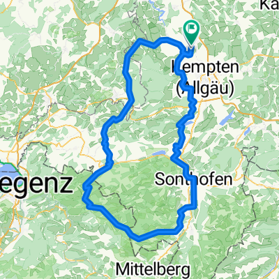
Rund um Kempten
A cycling route starting in Lauben, Bavaria, Germany.
Overview
About this route
Start in Krugzell - Altusried - Wiggensbach - Niedersonthofener See - Immenstadt - Burgberg - Winkel - Königsträßle - Ellegg - Rottachsee - Durach - Lenzfried - Leupolz - Heising - Gräbelesmühle - Krugzell
(cloned from route 3183962)- -:--
- Duration
- 107.4 km
- Distance
- 894 m
- Ascent
- 894 m
- Descent
- ---
- Avg. speed
- ---
- Avg. speed

Route quality
Waytypes & surfaces along the route
Waytypes
Quiet road
51.5 km
(48 %)
Road
20.2 km
(19 %)
Surfaces
Paved
91.2 km
(85 %)
Unpaved
0.2 km
(<1 %)
Asphalt
87.1 km
(81 %)
Paved (undefined)
2.6 km
(2 %)
Continue with Bikemap
Use, edit, or download this cycling route
You would like to ride Rund um Kempten or customize it for your own trip? Here is what you can do with this Bikemap route:
Free features
- Save this route as favorite or in collections
- Copy & plan your own version of this route
- Sync your route with Garmin or Wahoo
Premium features
Free trial for 3 days, or one-time payment. More about Bikemap Premium.
- Navigate this route on iOS & Android
- Export a GPX / KML file of this route
- Create your custom printout (try it for free)
- Download this route for offline navigation
Discover more Premium features.
Get Bikemap PremiumFrom our community
Other popular routes starting in Lauben
 Wild West ride out - small version
- Distance
- 9.9 km
- Ascent
- 86 m
- Descent
- 86 m
- Location
- Lauben, Bavaria, Germany
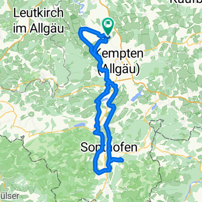 Krugzell - Sonthofener Hof
- Distance
- 124.6 km
- Ascent
- 1,003 m
- Descent
- 1,003 m
- Location
- Lauben, Bavaria, Germany
 Tagestour entlang der Allgäuer Alpen
- Distance
- 164.9 km
- Ascent
- 1,064 m
- Descent
- 1,060 m
- Location
- Lauben, Bavaria, Germany
 Winklerstraße 32, Lauben nach Winklerstraße 32, Lauben
- Distance
- 500.1 km
- Ascent
- 3,829 m
- Descent
- 3,859 m
- Location
- Lauben, Bavaria, Germany
 Daily Route
- Distance
- 33.1 km
- Ascent
- 397 m
- Descent
- 397 m
- Location
- Lauben, Bavaria, Germany
 555
555- Distance
- 271.2 km
- Ascent
- 2,774 m
- Descent
- 3,170 m
- Location
- Lauben, Bavaria, Germany
 ?§-Ù? nach ?§-Ù?
- Distance
- 9.6 km
- Ascent
- 40 m
- Descent
- 0 m
- Location
- Lauben, Bavaria, Germany
 Krugzell - Bregenzer Wald - Bodensee
- Distance
- 117.5 km
- Ascent
- 1,184 m
- Descent
- 1,447 m
- Location
- Lauben, Bavaria, Germany
Open it in the app