
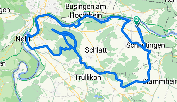
Kohlfirst - Rheinfall
A cycling route starting in Diessenhofen, Thurgau, Switzerland.
Overview
About this route
Meist Feld- und Waldstrassen und Teilstücke auf Asphalt. Leichte Steigungen. Singeltrail.
- -:--
- Duration
- 56.6 km
- Distance
- 421 m
- Ascent
- 426 m
- Descent
- ---
- Avg. speed
- ---
- Avg. speed
Route quality
Waytypes & surfaces along the route
Waytypes
Track
27.1 km
(48 %)
Quiet road
11.8 km
(21 %)
Surfaces
Paved
20.7 km
(37 %)
Unpaved
28.3 km
(50 %)
Asphalt
19.8 km
(35 %)
Pebblestone
9.9 km
(18 %)
Continue with Bikemap
Use, edit, or download this cycling route
You would like to ride Kohlfirst - Rheinfall or customize it for your own trip? Here is what you can do with this Bikemap route:
Free features
- Save this route as favorite or in collections
- Copy & plan your own version of this route
- Sync your route with Garmin or Wahoo
Premium features
Free trial for 3 days, or one-time payment. More about Bikemap Premium.
- Navigate this route on iOS & Android
- Export a GPX / KML file of this route
- Create your custom printout (try it for free)
- Download this route for offline navigation
Discover more Premium features.
Get Bikemap PremiumFrom our community
Other popular routes starting in Diessenhofen
 Diessenhofen-Ramsener Blick
- Distance
- 22.8 km
- Ascent
- 569 m
- Descent
- 574 m
- Location
- Diessenhofen, Thurgau, Switzerland
 Diessenhohen- Stein am Rhein
- Distance
- 20 km
- Ascent
- 214 m
- Descent
- 214 m
- Location
- Diessenhofen, Thurgau, Switzerland
 Die einfache Runde
- Distance
- 47.4 km
- Ascent
- 214 m
- Descent
- 210 m
- Location
- Diessenhofen, Thurgau, Switzerland
 Diessenhofen - Schlattingen
- Distance
- 17.1 km
- Ascent
- 285 m
- Descent
- 282 m
- Location
- Diessenhofen, Thurgau, Switzerland
 Schaffhausen
- Distance
- 19.6 km
- Ascent
- 102 m
- Descent
- 94 m
- Location
- Diessenhofen, Thurgau, Switzerland
 Tri Schaffhausen Kurzdistanz 31.3km
- Distance
- 31.3 km
- Ascent
- 390 m
- Descent
- 390 m
- Location
- Diessenhofen, Thurgau, Switzerland
 AT-Biketour 2014
- Distance
- 34 km
- Ascent
- 318 m
- Descent
- 318 m
- Location
- Diessenhofen, Thurgau, Switzerland
 Rundtour über Rodenberg -Schienerberg - Hohenklingen
- Distance
- 45.8 km
- Ascent
- 1,010 m
- Descent
- 1,014 m
- Location
- Diessenhofen, Thurgau, Switzerland
Open it in the app