

Meusegast-Mückentürmchen ü. Döbra
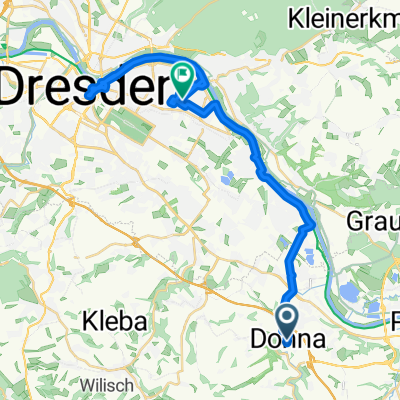
A cycling route starting in Dohna, Saxony, Germany.
Overview
About this route
Schöne Tour mal nicht durch das Müglitztal. Wenig Verkehr auf den Strassen.
- -:--
- Duration
- 30.6 km
- Distance
- 661 m
- Ascent
- 136 m
- Descent
- ---
- Avg. speed
- ---
- Avg. speed
Route quality
Waytypes & surfaces along the route
Waytypes
Road
16.5 km
(54 %)
Quiet road
10.4 km
(34 %)
Surfaces
Paved
17.8 km
(58 %)
Unpaved
2.4 km
(8 %)
Asphalt
17.6 km
(57 %)
Unpaved (undefined)
2.4 km
(8 %)
Continue with Bikemap
Use, edit, or download this cycling route
You would like to ride Meusegast-Mückentürmchen ü. Döbra or customize it for your own trip? Here is what you can do with this Bikemap route:
Free features
- Save this route as favorite or in collections
- Copy & plan your own version of this route
- Sync your route with Garmin or Wahoo
Premium features
Free trial for 3 days, or one-time payment. More about Bikemap Premium.
- Navigate this route on iOS & Android
- Export a GPX / KML file of this route
- Create your custom printout (try it for free)
- Download this route for offline navigation
Discover more Premium features.
Get Bikemap PremiumFrom our community
Other popular routes starting in Dohna
 DOHNA UND EINMAL DRESDEN
- Distance
- 31.8 km
- Ascent
- 50 m
- Descent
- 91 m
- Location
- Dohna, Saxony, Germany
 Falkenhain - Königstein (Rollerrunde)
- Distance
- 29.9 km
- Ascent
- 202 m
- Descent
- 312 m
- Location
- Dohna, Saxony, Germany
 Niederlausitz
- Distance
- 112.7 km
- Ascent
- 642 m
- Descent
- 639 m
- Location
- Dohna, Saxony, Germany
 Tour 1
- Distance
- 49.3 km
- Ascent
- 548 m
- Descent
- 548 m
- Location
- Dohna, Saxony, Germany
 Trainingsrunde DSC Borthen-Borthen Dohna zuhause
- Distance
- 23.1 km
- Ascent
- 317 m
- Descent
- 319 m
- Location
- Dohna, Saxony, Germany
 Müglitztal
- Distance
- 68.5 km
- Ascent
- 1,298 m
- Descent
- 1,214 m
- Location
- Dohna, Saxony, Germany
 Tour 3
- Distance
- 104.5 km
- Ascent
- 1,258 m
- Descent
- 1,258 m
- Location
- Dohna, Saxony, Germany
 Durch`s Müglitztal-Altenberg-auf Kahleberg u. zurück
- Distance
- 81.1 km
- Ascent
- 819 m
- Descent
- 820 m
- Location
- Dohna, Saxony, Germany
Open it in the app