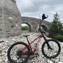
Mannheim - Elora Loop
A cycling route starting in Kitchener, Ontario, Canada.
Overview
About this route
From Mannheim, north through the Waterloo Moraine and rolling farmland, to Elora for coffee and buttertarts. 871m of climbing! (despite what Bikemap says -- its climb algorithm is screwed up).
- -:--
- Duration
- 105.6 km
- Distance
- 308 m
- Ascent
- 308 m
- Descent
- ---
- Avg. speed
- ---
- Avg. speed
Route highlights
Points of interest along the route

Point of interest after 18.3 km
Endless rolling hills

Point of interest after 55.7 km
Dalby House, Elora

Point of interest after 55.9 km
Refuge Coffee Lounge in Elora for coffee and buttertarts.

Point of interest after 67.4 km
Kissing Bridge, West Montrose

Point of interest after 87.2 km
Rolling hills of Waterloo County
Continue with Bikemap
Use, edit, or download this cycling route
You would like to ride Mannheim - Elora Loop or customize it for your own trip? Here is what you can do with this Bikemap route:
Free features
- Save this route as favorite or in collections
- Copy & plan your own version of this route
- Sync your route with Garmin or Wahoo
Premium features
Free trial for 3 days, or one-time payment. More about Bikemap Premium.
- Navigate this route on iOS & Android
- Export a GPX / KML file of this route
- Create your custom printout (try it for free)
- Download this route for offline navigation
Discover more Premium features.
Get Bikemap PremiumFrom our community
Other popular routes starting in Kitchener
 Vincenzo's Sammy Run
- Distance
- 30.7 km
- Ascent
- 132 m
- Descent
- 132 m
- Location
- Kitchener, Ontario, Canada
 Monarch Woods Dr, Kitchener to Monarch Woods Dr, Kitchener
- Distance
- 26.6 km
- Ascent
- 250 m
- Descent
- 253 m
- Location
- Kitchener, Ontario, Canada
 To the 'Loo and Back
- Distance
- 10.7 km
- Ascent
- 21 m
- Descent
- 18 m
- Location
- Kitchener, Ontario, Canada
 Sandhills Rebel Creek Loop 50km
- Distance
- 50.6 km
- Ascent
- 261 m
- Descent
- 261 m
- Location
- Kitchener, Ontario, Canada
 Monarch Woods Dr, Kitchener
- Distance
- 11.9 km
- Ascent
- 126 m
- Descent
- 113 m
- Location
- Kitchener, Ontario, Canada
 Monarch Woods Dr, Kitchener to Monarch Woods Dr, Kitchener
- Distance
- 29 km
- Ascent
- 271 m
- Descent
- 268 m
- Location
- Kitchener, Ontario, Canada
 Hydrocut Time Trial
- Distance
- 15.2 km
- Ascent
- 208 m
- Descent
- 206 m
- Location
- Kitchener, Ontario, Canada
 100 k along the river
- Distance
- 104.8 km
- Ascent
- 267 m
- Descent
- 267 m
- Location
- Kitchener, Ontario, Canada
Open it in the app


