

Monte Plazza - 72B Sentiero delle Aquile
A cycling route starting in Incudine, Lombardy, Italy.
Overview
About this route
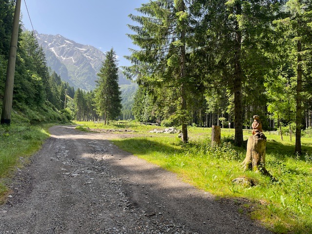
Splendida gita nel Parco Adamello. Da Incudine salendo per la Val Moriana, oltrepassate le baite Cavallo e quelle di Niclo, si abbandona la via di S.Anna e si sale a sx seguendo il segnavia 72B (Sentiero delle Aquile) fino a raggiungere il Plàs di Tremùt sotto il Monte Plazza dove la vista spazia a 360° sui monti camuni
- -:--
- Duration
- 23.9 km
- Distance
- 1,181 m
- Ascent
- 1,181 m
- Descent
- ---
- Avg. speed
- ---
- Avg. speed

Continue with Bikemap
Use, edit, or download this cycling route
You would like to ride Monte Plazza - 72B Sentiero delle Aquile or customize it for your own trip? Here is what you can do with this Bikemap route:
Free features
- Save this route as favorite or in collections
- Copy & plan your own version of this route
- Sync your route with Garmin or Wahoo
Premium features
Free trial for 3 days, or one-time payment. More about Bikemap Premium.
- Navigate this route on iOS & Android
- Export a GPX / KML file of this route
- Create your custom printout (try it for free)
- Download this route for offline navigation
Discover more Premium features.
Get Bikemap PremiumFrom our community
Other popular routes starting in Incudine
 Incudine- Laognì
- Distance
- 27.4 km
- Ascent
- 409 m
- Descent
- 379 m
- Location
- Incudine, Lombardy, Italy
 Valle dellOgliolo (percorso breve)
- Distance
- 23.7 km
- Ascent
- 412 m
- Descent
- 412 m
- Location
- Incudine, Lombardy, Italy
 Incudine- Temù
- Distance
- 22.6 km
- Ascent
- 293 m
- Descent
- 283 m
- Location
- Incudine, Lombardy, Italy
 Monte Plazza - 72B Sentiero delle Aquile
- Distance
- 23.9 km
- Ascent
- 1,181 m
- Descent
- 1,181 m
- Location
- Incudine, Lombardy, Italy
 Incudine- Temù- Valàr
- Distance
- 22.5 km
- Ascent
- 281 m
- Descent
- 266 m
- Location
- Incudine, Lombardy, Italy
 Carbonaiola (Parco Adamello)
- Distance
- 23.9 km
- Ascent
- 617 m
- Descent
- 617 m
- Location
- Incudine, Lombardy, Italy
 Incudine- Le Cascatelle
- Distance
- 11.8 km
- Ascent
- 272 m
- Descent
- 271 m
- Location
- Incudine, Lombardy, Italy
 Incudine- Temù
- Distance
- 24.8 km
- Ascent
- 316 m
- Descent
- 305 m
- Location
- Incudine, Lombardy, Italy
Open it in the app