

Col de Corbier, Pas de Morgins, Col de Bassachaux, Col de la Joux Verte
A cycling route starting in Morzine, Auvergne-Rhône-Alpes, France.
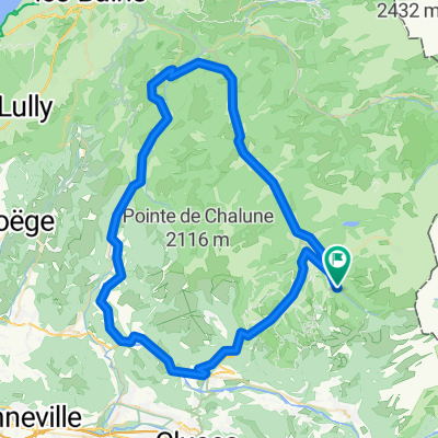
Overview
About this route
The entire route is paved EXCEPT between Bassachaux and near Lindarets, which is a steep gravel ski slope
- -:--
- Duration
- 71 km
- Distance
- 1,836 m
- Ascent
- 1,850 m
- Descent
- ---
- Avg. speed
- ---
- Avg. speed

Route highlights
Points of interest along the route
Point of interest after 13.4 km
Col du Corbier
Point of interest after 37.5 km
Pas de Morgins
Point of interest after 52.3 km
Col de Bassachaux
Point of interest after 58.7 km
Col de la Joux Verte
Continue with Bikemap
Use, edit, or download this cycling route
You would like to ride Col de Corbier, Pas de Morgins, Col de Bassachaux, Col de la Joux Verte or customize it for your own trip? Here is what you can do with this Bikemap route:
Free features
- Save this route as favorite or in collections
- Copy & plan your own version of this route
- Sync your route with Garmin or Wahoo
Premium features
Free trial for 3 days, or one-time payment. More about Bikemap Premium.
- Navigate this route on iOS & Android
- Export a GPX / KML file of this route
- Create your custom printout (try it for free)
- Download this route for offline navigation
Discover more Premium features.
Get Bikemap PremiumFrom our community
Other popular routes starting in Morzine
 gets rondje
- Distance
- 44.5 km
- Ascent
- 1,626 m
- Descent
- 1,574 m
- Location
- Morzine, Auvergne-Rhône-Alpes, France
 Tour d'Enfer : Day 1 - Morzine to La Clusaz
- Distance
- 75.7 km
- Ascent
- 1,814 m
- Descent
- 1,629 m
- Location
- Morzine, Auvergne-Rhône-Alpes, France
 Morzine - Col de la Joux Verte
- Distance
- 30.3 km
- Ascent
- 861 m
- Descent
- 861 m
- Location
- Morzine, Auvergne-Rhône-Alpes, France
 Morzine-Avoriaz
- Distance
- 29.2 km
- Ascent
- 922 m
- Descent
- 906 m
- Location
- Morzine, Auvergne-Rhône-Alpes, France
 Morzine Sportive - Short Version
- Distance
- 103.6 km
- Ascent
- 1,763 m
- Descent
- 1,761 m
- Location
- Morzine, Auvergne-Rhône-Alpes, France
 Tour du Roc d'Enfer
- Distance
- 78.9 km
- Ascent
- 1,128 m
- Descent
- 1,121 m
- Location
- Morzine, Auvergne-Rhône-Alpes, France
 Day 1
Day 1- Distance
- 137.6 km
- Ascent
- 3,476 m
- Descent
- 3,461 m
- Location
- Morzine, Auvergne-Rhône-Alpes, France
 Morzine - Col de la Ramaz - Col de la Colombière
- Distance
- 133.7 km
- Ascent
- 2,660 m
- Descent
- 2,654 m
- Location
- Morzine, Auvergne-Rhône-Alpes, France
Open it in the app