

Elstertalradweg Adorf - Plauen ob Bahnhof
A cycling route starting in Schöneck, Saxony, Germany.
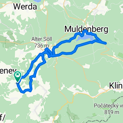
Overview
About this route
Von Adorf bis Pirk recht hügelig mit einigigen Anstiegen und Abfahrten. Nachteil dabei ist die kurzzeitige Benutzung der B92. Ab Bahnhof Pirk eine sehr schöne Strecke bis Plauen. Fast nur ebene Streckeohne größere Hügel!
- -:--
- Duration
- 43.2 km
- Distance
- 311 m
- Ascent
- 422 m
- Descent
- ---
- Avg. speed
- ---
- Avg. speed

Continue with Bikemap
Use, edit, or download this cycling route
You would like to ride Elstertalradweg Adorf - Plauen ob Bahnhof or customize it for your own trip? Here is what you can do with this Bikemap route:
Free features
- Save this route as favorite or in collections
- Copy & plan your own version of this route
- Sync your route with Garmin or Wahoo
Premium features
Free trial for 3 days, or one-time payment. More about Bikemap Premium.
- Navigate this route on iOS & Android
- Export a GPX / KML file of this route
- Create your custom printout (try it for free)
- Download this route for offline navigation
Discover more Premium features.
Get Bikemap PremiumFrom our community
Other popular routes starting in Schöneck
 Wohlbach - Adorf - Siebenbrunn - Gunzen - Wohlbach
- Distance
- 21.8 km
- Ascent
- 264 m
- Descent
- 217 m
- Location
- Schöneck, Saxony, Germany
 Wohlbach-Schöneck-Erlbach-Wohlbach
- Distance
- 41.7 km
- Ascent
- 717 m
- Descent
- 764 m
- Location
- Schöneck, Saxony, Germany
 1.Tag unserer Kammtour
- Distance
- 102.6 km
- Ascent
- 1,227 m
- Descent
- 1,107 m
- Location
- Schöneck, Saxony, Germany
 Wohlbach - Vogtlandarena
- Distance
- 16.6 km
- Ascent
- 418 m
- Descent
- 184 m
- Location
- Schöneck, Saxony, Germany
 Wohlbach - Erlbach - Markneukirchen - Adorf - Saalig
- Distance
- 37.4 km
- Ascent
- 468 m
- Descent
- 468 m
- Location
- Schöneck, Saxony, Germany
 Wohlbach-Schöneck-Talsperre Muldenberg
- Distance
- 31.6 km
- Ascent
- 536 m
- Descent
- 534 m
- Location
- Schöneck, Saxony, Germany
 Wohlbach-Adorf-Sohl-Markneukirchen(Berg)-Breitenfeld
- Distance
- 33 km
- Ascent
- 470 m
- Descent
- 470 m
- Location
- Schöneck, Saxony, Germany
 Schöneck - Pressel
- Distance
- 176.9 km
- Ascent
- 333 m
- Descent
- 919 m
- Location
- Schöneck, Saxony, Germany
Open it in the app