

Korkenziehertrasse
A cycling route starting in Remscheid, North Rhine-Westphalia, Germany.
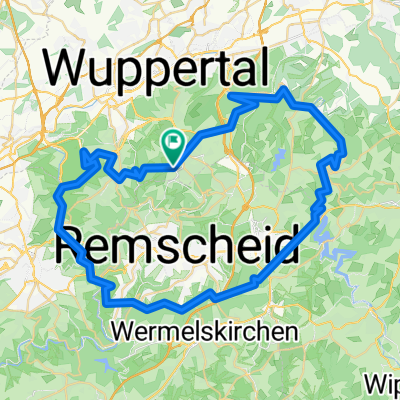
Overview
About this route
Im Zuge der Regionale 2006 wurde die Idee einer Rad- und Fußverbindung auf dieser ehemaligen Eisenbahnstrecke zur Realität.
- -:--
- Duration
- 61.2 km
- Distance
- 201 m
- Ascent
- 488 m
- Descent
- ---
- Avg. speed
- ---
- Avg. speed

Route quality
Waytypes & surfaces along the route
Waytypes
Path
18.2 km
(30 %)
Quiet road
12.3 km
(20 %)
Surfaces
Paved
47 km
(77 %)
Unpaved
6 km
(10 %)
Asphalt
42.3 km
(69 %)
Paving stones
3.6 km
(6 %)
Continue with Bikemap
Use, edit, or download this cycling route
You would like to ride Korkenziehertrasse or customize it for your own trip? Here is what you can do with this Bikemap route:
Free features
- Save this route as favorite or in collections
- Copy & plan your own version of this route
- Sync your route with Garmin or Wahoo
Premium features
Free trial for 3 days, or one-time payment. More about Bikemap Premium.
- Navigate this route on iOS & Android
- Export a GPX / KML file of this route
- Create your custom printout (try it for free)
- Download this route for offline navigation
Discover more Premium features.
Get Bikemap PremiumFrom our community
Other popular routes starting in Remscheid
 73 Km durchs Bergische Land
- Distance
- 73.9 km
- Ascent
- 726 m
- Descent
- 744 m
- Location
- Remscheid, North Rhine-Westphalia, Germany
 Entlang der Wupper zum Rhein
- Distance
- 95.8 km
- Ascent
- 757 m
- Descent
- 813 m
- Location
- Remscheid, North Rhine-Westphalia, Germany
 Remscheid, Schloss Burg und Morsbachtal
- Distance
- 29.5 km
- Ascent
- 568 m
- Descent
- 590 m
- Location
- Remscheid, North Rhine-Westphalia, Germany
 Große MTB Burgholz
- Distance
- 62.1 km
- Ascent
- 1,036 m
- Descent
- 1,106 m
- Location
- Remscheid, North Rhine-Westphalia, Germany
 Remscheid - Kürten - Wipperfürth - Hückeswagen - Remscheid
- Distance
- 55.8 km
- Ascent
- 725 m
- Descent
- 750 m
- Location
- Remscheid, North Rhine-Westphalia, Germany
 30 Km um die Wuppersperre
- Distance
- 29.3 km
- Ascent
- 394 m
- Descent
- 394 m
- Location
- Remscheid, North Rhine-Westphalia, Germany
 Rund in Lüttringhausen
- Distance
- 7.6 km
- Ascent
- 94 m
- Descent
- 126 m
- Location
- Remscheid, North Rhine-Westphalia, Germany
 Rund um Remscheid2
- Distance
- 48.9 km
- Ascent
- 815 m
- Descent
- 826 m
- Location
- Remscheid, North Rhine-Westphalia, Germany