

Rondje vanuit L'Argentiere
A cycling route starting in Largentière, Auvergne-Rhône-Alpes, France.
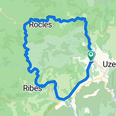
Overview
About this route
rit over de col de la Croix de Bauzon (1308 m) en de col du Meyrand (1371 m)
- -:--
- Duration
- 81.3 km
- Distance
- 1,902 m
- Ascent
- 1,923 m
- Descent
- ---
- Avg. speed
- ---
- Max. altitude
Route quality
Waytypes & surfaces along the route
Waytypes
Busy road
54.7 km
(67 %)
Road
9.3 km
(11 %)
Surfaces
Paved
30.2 km
(37 %)
Unpaved
8.1 km
(10 %)
Asphalt
26.3 km
(32 %)
Ground
5.8 km
(7 %)
Continue with Bikemap
Use, edit, or download this cycling route
You would like to ride Rondje vanuit L'Argentiere or customize it for your own trip? Here is what you can do with this Bikemap route:
Free features
- Save this route as favorite or in collections
- Copy & plan your own version of this route
- Split it into stages to create a multi-day tour
- Sync your route with Garmin or Wahoo
Premium features
Free trial for 3 days, or one-time payment. More about Bikemap Premium.
- Navigate this route on iOS & Android
- Export a GPX / KML file of this route
- Create your custom printout (try it for free)
- Download this route for offline navigation
Discover more Premium features.
Get Bikemap PremiumFrom our community
Other popular routes starting in Largentière
 Halbe Tour am Col de Meyrand
- Distance
- 28.1 km
- Ascent
- 921 m
- Descent
- 916 m
- Location
- Largentière, Auvergne-Rhône-Alpes, France
 2016 Ride Day 109 - Largentière to Villefort
- Distance
- 47 km
- Ascent
- 863 m
- Descent
- 386 m
- Location
- Largentière, Auvergne-Rhône-Alpes, France
 ruoms
ruoms- Distance
- 44.8 km
- Ascent
- 713 m
- Descent
- 710 m
- Location
- Largentière, Auvergne-Rhône-Alpes, France
 La Landeà vélo
- Distance
- 35.6 km
- Ascent
- 502 m
- Descent
- 502 m
- Location
- Largentière, Auvergne-Rhône-Alpes, France
 Largentière-Pässefahrt
- Distance
- 84.8 km
- Ascent
- 3,418 m
- Descent
- 3,112 m
- Location
- Largentière, Auvergne-Rhône-Alpes, France
 03.05. Rochecolombe
- Distance
- 34.6 km
- Ascent
- 502 m
- Descent
- 628 m
- Location
- Largentière, Auvergne-Rhône-Alpes, France
 Rondje vanuit L'Argentiere
- Distance
- 81.3 km
- Ascent
- 1,902 m
- Descent
- 1,923 m
- Location
- Largentière, Auvergne-Rhône-Alpes, France
 Salindré - Rosière
- Distance
- 40 km
- Ascent
- 403 m
- Descent
- 406 m
- Location
- Largentière, Auvergne-Rhône-Alpes, France
Open it in the app