

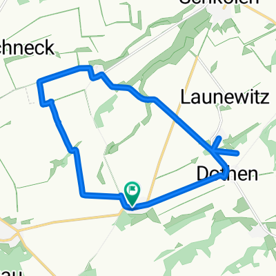
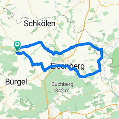
20150902_174837.gpx
A cycling route starting in Mertendorf, Free State of Thuringia, Germany.
Overview
About this route
TEASI track
- -:--
- Duration
- 15 km
- Distance
- 106 m
- Ascent
- 106 m
- Descent
- ---
- Avg. speed
- ---
- Avg. speed
Route quality
Waytypes & surfaces along the route
Waytypes
Quiet road
7 km
(47 %)
Busy road
3.9 km
(26 %)
Surfaces
Paved
15 km
(100 %)
Asphalt
15 km
(100 %)
Continue with Bikemap
Use, edit, or download this cycling route
You would like to ride 20150902_174837.gpx or customize it for your own trip? Here is what you can do with this Bikemap route:
Free features
- Save this route as favorite or in collections
- Copy & plan your own version of this route
- Sync your route with Garmin or Wahoo
Premium features
Free trial for 3 days, or one-time payment. More about Bikemap Premium.
- Navigate this route on iOS & Android
- Export a GPX / KML file of this route
- Create your custom printout (try it for free)
- Download this route for offline navigation
Discover more Premium features.
Get Bikemap PremiumFrom our community
Other popular routes starting in Mertendorf
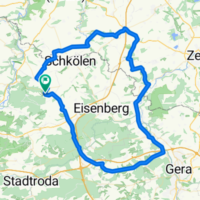
 ins Weingebiet
- Distance
- 89.5 km
- Ascent
- 731 m
- Descent
- 815 m
- Location
- Mertendorf, Free State of Thuringia, Germany
 schöne Runde über ruhige Strassen
- Distance
- 84.9 km
- Ascent
- 532 m
- Descent
- 549 m
- Location
- Mertendorf, Free State of Thuringia, Germany
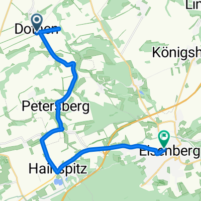 Entspannende Route in Eisenberg
- Distance
- 13.5 km
- Ascent
- 174 m
- Descent
- 170 m
- Location
- Mertendorf, Free State of Thuringia, Germany
 Dothen 20 a, Schkölen nach Orlagasse 2, Neustadt an der Orla
- Distance
- 48.5 km
- Ascent
- 673 m
- Descent
- 649 m
- Location
- Mertendorf, Free State of Thuringia, Germany
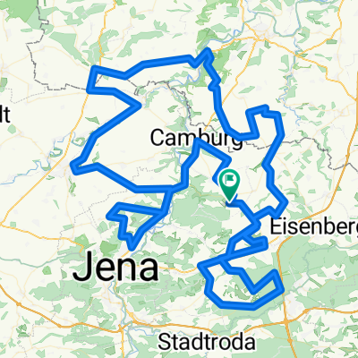 Rund um Rockau - kurz CLONED FROM ROUTE 829898
- Distance
- 173.2 km
- Ascent
- 1,212 m
- Descent
- 1,212 m
- Location
- Mertendorf, Free State of Thuringia, Germany
 Poppendorf 6, Schkölen nach Poppendorf 32, Schkölen
- Distance
- 11.6 km
- Ascent
- 101 m
- Descent
- 106 m
- Location
- Mertendorf, Free State of Thuringia, Germany
 schöne kurze Ausfahrt
- Distance
- 45.4 km
- Ascent
- 464 m
- Descent
- 478 m
- Location
- Mertendorf, Free State of Thuringia, Germany
 20150902_174837.gpx
- Distance
- 15 km
- Ascent
- 106 m
- Descent
- 106 m
- Location
- Mertendorf, Free State of Thuringia, Germany
Open it in the app