

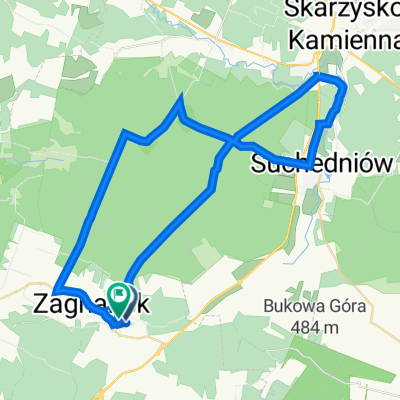
odyseja zagnańska
A cycling route starting in Zagnańsk, Świętokrzyskie Voivodship, Poland.
Overview
About this route
byczo kaczo i indyczo
- -:--
- Duration
- 102.5 km
- Distance
- 709 m
- Ascent
- 709 m
- Descent
- ---
- Avg. speed
- ---
- Avg. speed

Route quality
Waytypes & surfaces along the route
Waytypes
Track
45.1 km
(44 %)
Path
21.4 km
(21 %)
Surfaces
Paved
20 km
(19 %)
Unpaved
35.4 km
(34 %)
Gravel
20.3 km
(20 %)
Asphalt
18.7 km
(18 %)
Continue with Bikemap
Use, edit, or download this cycling route
You would like to ride odyseja zagnańska or customize it for your own trip? Here is what you can do with this Bikemap route:
Free features
- Save this route as favorite or in collections
- Copy & plan your own version of this route
- Sync your route with Garmin or Wahoo
Premium features
Free trial for 3 days, or one-time payment. More about Bikemap Premium.
- Navigate this route on iOS & Android
- Export a GPX / KML file of this route
- Create your custom printout (try it for free)
- Download this route for offline navigation
Discover more Premium features.
Get Bikemap PremiumFrom our community
Other popular routes starting in Zagnańsk
 Zalew Sielpia - krótsza wersja
- Distance
- 89.3 km
- Ascent
- 845 m
- Descent
- 845 m
- Location
- Zagnańsk, Świętokrzyskie Voivodship, Poland
 ewaaaaa
- Distance
- 48.3 km
- Ascent
- 372 m
- Descent
- 370 m
- Location
- Zagnańsk, Świętokrzyskie Voivodship, Poland
 Zalew Rejowski
- Distance
- 50.5 km
- Ascent
- 624 m
- Descent
- 623 m
- Location
- Zagnańsk, Świętokrzyskie Voivodship, Poland
 WISIÓWKA II
- Distance
- 15.5 km
- Ascent
- 364 m
- Descent
- 245 m
- Location
- Zagnańsk, Świętokrzyskie Voivodship, Poland
 Góry Świętokrzyskie - wersja krótka
- Distance
- 52 km
- Ascent
- 538 m
- Descent
- 537 m
- Location
- Zagnańsk, Świętokrzyskie Voivodship, Poland
 Krasna z Zagańska
- Distance
- 58.2 km
- Ascent
- 468 m
- Descent
- 467 m
- Location
- Zagnańsk, Świętokrzyskie Voivodship, Poland
 Góry Świętokrzyskie - wersja długa
- Distance
- 97.7 km
- Ascent
- 1,248 m
- Descent
- 1,245 m
- Location
- Zagnańsk, Świętokrzyskie Voivodship, Poland
 Zalew Sielpia
- Distance
- 101.7 km
- Ascent
- 839 m
- Descent
- 839 m
- Location
- Zagnańsk, Świętokrzyskie Voivodship, Poland
Open it in the app