

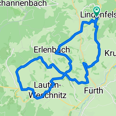
Panoramatour um Lindenfels
A cycling route starting in Lindenfels, Hesse, Germany.
Overview
About this route
abwechslungsreiche Tour mit schönen Aussichten durch Wiesen und Wälder. Startpunkt Lindenfels Stadtmitte am Löwenbrunnen. Schwierigkeit mittel.
(cloned from route 3217391)
- -:--
- Duration
- 24.8 km
- Distance
- 644 m
- Ascent
- 621 m
- Descent
- ---
- Avg. speed
- ---
- Avg. speed
Continue with Bikemap
Use, edit, or download this cycling route
You would like to ride Panoramatour um Lindenfels or customize it for your own trip? Here is what you can do with this Bikemap route:
Free features
- Save this route as favorite or in collections
- Copy & plan your own version of this route
- Sync your route with Garmin or Wahoo
Premium features
Free trial for 3 days, or one-time payment. More about Bikemap Premium.
- Navigate this route on iOS & Android
- Export a GPX / KML file of this route
- Create your custom printout (try it for free)
- Download this route for offline navigation
Discover more Premium features.
Get Bikemap PremiumFrom our community
Other popular routes starting in Lindenfels
 Lindenfels - Reichenbach - Lindenfels
- Distance
- 30.9 km
- Ascent
- 747 m
- Descent
- 747 m
- Location
- Lindenfels, Hesse, Germany
 Bensheim-Knoden-Bensheim
- Distance
- 20.4 km
- Ascent
- 114 m
- Descent
- 501 m
- Location
- Lindenfels, Hesse, Germany
 Rund um Lindenfels
- Distance
- 25.4 km
- Ascent
- 648 m
- Descent
- 648 m
- Location
- Lindenfels, Hesse, Germany
 Lindenfels-Knodener Kopf-Reichenbach-Hohenstein-Lindenfels
- Distance
- 29.1 km
- Ascent
- 668 m
- Descent
- 667 m
- Location
- Lindenfels, Hesse, Germany
 Winkel - Fürth - Reichelsheim - Fränkisch Crumbach - Groß Bieberau - Ober Ramstadt - DA City
- Distance
- 48 km
- Ascent
- 320 m
- Descent
- 383 m
- Location
- Lindenfels, Hesse, Germany
 Lindenfels - Talfahrt in offenes Wiesen gelände
- Distance
- 19.7 km
- Ascent
- 462 m
- Descent
- 465 m
- Location
- Lindenfels, Hesse, Germany
 Lindenfels - Seidenbuch - Kolmbach - Lindenfels
- Distance
- 18.7 km
- Ascent
- 483 m
- Descent
- 605 m
- Location
- Lindenfels, Hesse, Germany
 Lindenfels Ortsteil: Kolmbach Runde
- Distance
- 23.8 km
- Ascent
- 826 m
- Descent
- 709 m
- Location
- Lindenfels, Hesse, Germany
Open it in the app