

2014_09_07_3-Kaiserbergroute.gpx
A cycling route starting in Göppingen, Baden-Württemberg, Germany.
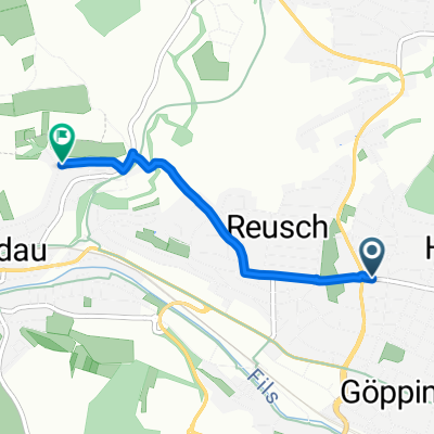
Overview
About this route
TEASI track
(cloned from route 2830955)- -:--
- Duration
- 51.4 km
- Distance
- 534 m
- Ascent
- 535 m
- Descent
- ---
- Avg. speed
- ---
- Avg. speed
Route quality
Waytypes & surfaces along the route
Waytypes
Quiet road
16 km
(31 %)
Path
15.1 km
(29 %)
Surfaces
Paved
44.9 km
(87 %)
Unpaved
1.3 km
(3 %)
Asphalt
38.8 km
(76 %)
Paved (undefined)
3.3 km
(6 %)
Continue with Bikemap
Use, edit, or download this cycling route
You would like to ride 2014_09_07_3-Kaiserbergroute.gpx or customize it for your own trip? Here is what you can do with this Bikemap route:
Free features
- Save this route as favorite or in collections
- Copy & plan your own version of this route
- Sync your route with Garmin or Wahoo
Premium features
Free trial for 3 days, or one-time payment. More about Bikemap Premium.
- Navigate this route on iOS & Android
- Export a GPX / KML file of this route
- Create your custom printout (try it for free)
- Download this route for offline navigation
Discover more Premium features.
Get Bikemap PremiumFrom our community
Other popular routes starting in Göppingen
 Göppingen - Hohenstaufen
- Distance
- 8.9 km
- Ascent
- 475 m
- Descent
- 197 m
- Location
- Göppingen, Baden-Württemberg, Germany
 Abendrunde MTB
- Distance
- 23.6 km
- Ascent
- 191 m
- Descent
- 191 m
- Location
- Göppingen, Baden-Württemberg, Germany
 Barbarossa-Lauf
- Distance
- 21.2 km
- Ascent
- 533 m
- Descent
- 483 m
- Location
- Göppingen, Baden-Württemberg, Germany
 zu Andrea ohne Berg
- Distance
- 2.5 km
- Ascent
- 36 m
- Descent
- 53 m
- Location
- Göppingen, Baden-Württemberg, Germany
 Göppingen - Drei Kaiser Berge
- Distance
- 31.8 km
- Ascent
- 770 m
- Descent
- 766 m
- Location
- Göppingen, Baden-Württemberg, Germany
 Training
- Distance
- 50.1 km
- Ascent
- 1,393 m
- Descent
- 1,504 m
- Location
- Göppingen, Baden-Württemberg, Germany
 kleine Göppingen Hügeltour
- Distance
- 44.5 km
- Ascent
- 567 m
- Descent
- 487 m
- Location
- Göppingen, Baden-Württemberg, Germany
 Falkenstraße 19, Göppingen nach Eybstraße 16/2, Geislingen an der Steige
- Distance
- 17 km
- Ascent
- 45 m
- Descent
- 0 m
- Location
- Göppingen, Baden-Württemberg, Germany
Open it in the app