

3. Gruibinger Albtraufmarathon Langstrecke
A cycling route starting in Gruibingen, Baden-Württemberg, Germany.
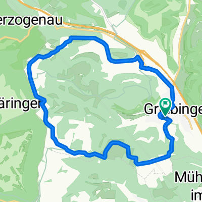
Overview
About this route
Langdistanz des 3. Gruibinger Albtraufmarathons 2015
- -:--
- Duration
- 81.7 km
- Distance
- 1,474 m
- Ascent
- 1,473 m
- Descent
- ---
- Avg. speed
- ---
- Avg. speed

Route quality
Waytypes & surfaces along the route
Waytypes
Track
66.8 km
(82 %)
Quiet road
8.2 km
(10 %)
Surfaces
Paved
25.4 km
(31 %)
Unpaved
53.7 km
(66 %)
Gravel
36.4 km
(45 %)
Asphalt
13.7 km
(17 %)
Continue with Bikemap
Use, edit, or download this cycling route
You would like to ride 3. Gruibinger Albtraufmarathon Langstrecke or customize it for your own trip? Here is what you can do with this Bikemap route:
Free features
- Save this route as favorite or in collections
- Copy & plan your own version of this route
- Sync your route with Garmin or Wahoo
Premium features
Free trial for 3 days, or one-time payment. More about Bikemap Premium.
- Navigate this route on iOS & Android
- Export a GPX / KML file of this route
- Create your custom printout (try it for free)
- Download this route for offline navigation
Discover more Premium features.
Get Bikemap PremiumFrom our community
Other popular routes starting in Gruibingen
 Alptraufmarathon (Gruibingen)
- Distance
- 59.3 km
- Ascent
- 1,108 m
- Descent
- 1,107 m
- Location
- Gruibingen, Baden-Württemberg, Germany
 Maierhofstraße 17/1, Gruibingen nach Maierhofstraße 17, Gruibingen
- Distance
- 15.5 km
- Ascent
- 310 m
- Descent
- 310 m
- Location
- Gruibingen, Baden-Württemberg, Germany
 Sickenbühl-Reisenstein-Bahnhöle -Neidlingen Reisenstein-Sickenbühl
- Distance
- 24.2 km
- Ascent
- 673 m
- Descent
- 660 m
- Location
- Gruibingen, Baden-Württemberg, Germany
 Buch - Bossler
- Distance
- 13.6 km
- Ascent
- 178 m
- Descent
- 195 m
- Location
- Gruibingen, Baden-Württemberg, Germany
 Buchsteig-Sickenbühl-Bossler
- Distance
- 13.4 km
- Ascent
- 411 m
- Descent
- 358 m
- Location
- Gruibingen, Baden-Württemberg, Germany
 Albtraufmarathon kurz
- Distance
- 59.5 km
- Ascent
- 1,103 m
- Descent
- 1,102 m
- Location
- Gruibingen, Baden-Württemberg, Germany
 Gruibingen - Kreuzkapelle Gosbach - Auendorf
- Distance
- 21.9 km
- Ascent
- 533 m
- Descent
- 505 m
- Location
- Gruibingen, Baden-Württemberg, Germany
 Gruibingen - Boll - Dürnau - Gammelshausen - Gruibingen
- Distance
- 17.2 km
- Ascent
- 334 m
- Descent
- 334 m
- Location
- Gruibingen, Baden-Württemberg, Germany
Open it in the app