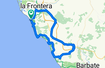
Cycling Route in Chiclana de la Frontera, Andalusia, Spain
E-NovoSanctiPetri-Conil-Cano-ret
0
Open this route in the Bikemap app

Open this route in Bikemap Web
72
km
Distance
Distance
342
m
Ascent
Ascent
341
m
Descent
Descent
-:--
h
Duration
Duration
--
km/h
Avg. Speed
Avg. Speed
---
m
Max. Elevation
Max. Elevation