Premium Badge Download on the App Store Get it on Google Play Turn-by-turn Navigation Offline Maps Bike Type Optimized Routing Premium Maps Custom Bike Computer Export Routes Route Previews Fall Detection Premium Support

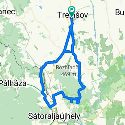
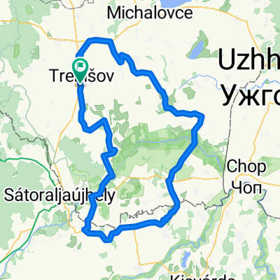
Cycling Route in Trebišov, Košický kraj, Slovak Republic

188,5 km* Cyklotrasa po Zemplínsky

0
Open this route in the Bikemap app

Open this route in the Bikemap app

Open this route in Bikemap Web

Open this route in Bikemap Web

191 km
Distance
168 m
Ascent
168 m
Descent
-:-- h
Duration
-- km/h
Avg. Speed
--- m
Max. Elevation

About This Route

Ráno 4:11 odchod a príchod doobedu 11.33 hod. Oblačno 14 stupňov ráno, postupne až do 21 stupňov. Vietor iba slabý premenlivý. Priemerná rýchlosť 26,3 km/h a maximálna rýchlosť 42,6 km/h

This cycling route is ideal for: Road bike

You will cycle on the following surfaces: Paved

Customize this cycling route with the Bikemap route planner.

Make it yours!

Did you know? You can use this route as a template in our cycling route planner if you don't wish to start from scratch. Customize it based on your needs to plan your perfect cycling tour.

Open it in the app