

Schlierbach - Oberschlierbach (Ortszentren, Umgehung von Hauptverkehrsstraßen)
A cycling route starting in Micheldorf in Oberösterreich, Upper Austria, Austria.
Overview
About this route
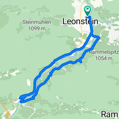
Vom Zentrum aus folgt man der Stiftsstraße (L1331) Richtung Norden ein wenig bergab, kurz nach der Linkskurve biegt man rechts ein Richtung Hofern, wonach es steil bergab und in Hofern nach wenigen Metern über den Ellersbach geht. Nachfolgend hält man sich rechts und fährt auf dieser Straße (Käfergraben) weiter Richtung Osten. Nach einigen Häusern beginnt ein Wald und damit ein steiler Anstieg; der Weg heißt nun Kaiserleithn. Auf dieser fährt man die nächsten 2 km fast immer bergauf. Danach kommt man an eine Kreuzung, auf der man sich recht hält, und in der folgenden Rechtskurve bleibt man rechts, befindet sich hier nun auf der Straße Oberschlierbach. Auf dieser fährt man etwa 1,5 km, bevor man sich an einer Abzweigung links halten muss (Ausschilderung Steyr, Grünburg). Nun befindet man sich auf der Schiefer Straße, auf welcher man nach wenigen hundert Metern das rechts befindliche Gemeindezentrum erreicht hat.
Dauer: etwa 40 Minuten (je nach Fitness und Rad wohl zwischen 30 und 60 Minuten)- -:--
- Duration
- 5.9 km
- Distance
- 355 m
- Ascent
- 41 m
- Descent
- ---
- Avg. speed
- ---
- Avg. speed
Route quality
Waytypes & surfaces along the route
Waytypes
Quiet road
4.5 km
(77 %)
Road
1.4 km
(23 %)
Undefined
-0 km
(<1 %)
Surfaces
Paved
1.5 km
(25 %)
Asphalt
1.5 km
(25 %)
Undefined
4.4 km
(75 %)
Continue with Bikemap
Use, edit, or download this cycling route
You would like to ride Schlierbach - Oberschlierbach (Ortszentren, Umgehung von Hauptverkehrsstraßen) or customize it for your own trip? Here is what you can do with this Bikemap route:
Free features
- Save this route as favorite or in collections
- Copy & plan your own version of this route
- Sync your route with Garmin or Wahoo
Premium features
Free trial for 3 days, or one-time payment. More about Bikemap Premium.
- Navigate this route on iOS & Android
- Export a GPX / KML file of this route
- Create your custom printout (try it for free)
- Download this route for offline navigation
Discover more Premium features.
Get Bikemap PremiumFrom our community
Other popular routes starting in Micheldorf in Oberösterreich
 RK Kremstalroas
- Distance
- 140.4 km
- Ascent
- 1,670 m
- Descent
- 1,670 m
- Location
- Micheldorf in Oberösterreich, Upper Austria, Austria
 2025_Micheldorf-Scharnstein
- Distance
- 54.6 km
- Ascent
- 2,176 m
- Descent
- 2,176 m
- Location
- Micheldorf in Oberösterreich, Upper Austria, Austria
 2025_Micheldorf-Weyregg
- Distance
- 76.3 km
- Ascent
- 2,274 m
- Descent
- 2,254 m
- Location
- Micheldorf in Oberösterreich, Upper Austria, Austria
 2025_zur Gabi
- Distance
- 7.5 km
- Ascent
- 80 m
- Descent
- 43 m
- Location
- Micheldorf in Oberösterreich, Upper Austria, Austria
 Route in Grünburg
- Distance
- 27.9 km
- Ascent
- 1,881 m
- Descent
- 1,885 m
- Location
- Micheldorf in Oberösterreich, Upper Austria, Austria
 Micheld. Sattlhald ZiehbergSender Lauterbach
- Distance
- 33.7 km
- Ascent
- 969 m
- Descent
- 969 m
- Location
- Micheldorf in Oberösterreich, Upper Austria, Austria
 Von Grünburg bis Alkoven
- Distance
- 65.6 km
- Ascent
- 554 m
- Descent
- 707 m
- Location
- Micheldorf in Oberösterreich, Upper Austria, Austria
 Zimekrunde
- Distance
- 18.1 km
- Ascent
- 355 m
- Descent
- 356 m
- Location
- Micheldorf in Oberösterreich, Upper Austria, Austria
Open it in the app