Premium Badge Download on the App Store Get it on Google Play Turn-by-turn Navigation Offline Maps Bike Type Optimized Routing Premium Maps Custom Bike Computer Export Routes Route Previews Fall Detection Premium Support

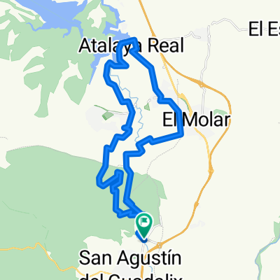
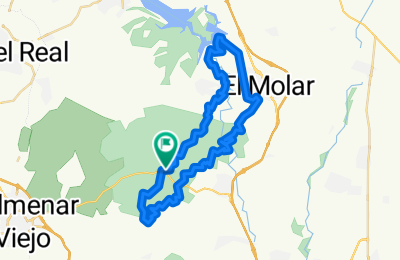
Cycling Route in San Agustín de Guadalix, Madrid, Spain

Casas del Canal-Pedrezuela-El Molar-San Agustín-... 12.10.15

0
Open this route in the Bikemap app

Open this route in the Bikemap app

Open this route in Bikemap Web

Open this route in Bikemap Web

44 km
Distance
459 m
Ascent
457 m
Descent
-:-- h
Duration
-- km/h
Avg. Speed
--- m
Max. Elevation

About This Route

Ruta en sentido horario de 43,8 km en 2:53 y 3:20 horas en total. En previsión de que hubiese barro y que lloviese, que luego no llovió, hacemos una ruta por las pistas de servicio del Canal de Isabel II, que pretendía ser de unos 60 km porque la hubiésemos alargado hasta la entrada a la finca del Castillo de Viñuelas, pero en último momento la cerramos en el km 38,9 cogiendo el atajo hacia la pista del km 40,39 que vuelva hacia las Casas del Canal. Ruta sin cuestas muy pinas por lo que se puede hacer a buen ritmo y que si destacamos algo es la bajada de 4 km desde la atalaya de El Molar hasta cruzar con el Río Guadalix.

This cycling route is ideal for: MTB

You will cycle on the following surfaces: Paved Unpaved Gravel

Customize this cycling route with the Bikemap route planner.

Make it yours!

Did you know? You can use this route as a template in our cycling route planner if you don't wish to start from scratch. Customize it based on your needs to plan your perfect cycling tour.

Open it in the app