

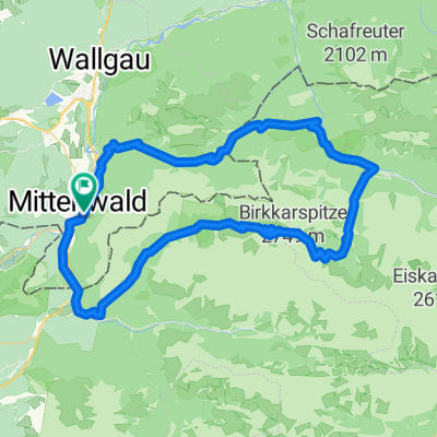
Isarradweg Mittenwald-Bad Tölz
A cycling route starting in Mittenwald, Bavaria, Germany.
Overview
About this route
nice route
(cloned from route 3303093)
- -:--
- Duration
- 57.7 km
- Distance
- 179 m
- Ascent
- 446 m
- Descent
- ---
- Avg. speed
- ---
- Avg. speed
Route quality
Waytypes & surfaces along the route
Waytypes
Busy road
18.4 km
(32 %)
Quiet road
17.4 km
(30 %)
Surfaces
Paved
51.2 km
(89 %)
Unpaved
4.3 km
(7 %)
Asphalt
50.1 km
(87 %)
Loose gravel
3 km
(5 %)
Continue with Bikemap
Use, edit, or download this cycling route
You would like to ride Isarradweg Mittenwald-Bad Tölz or customize it for your own trip? Here is what you can do with this Bikemap route:
Free features
- Save this route as favorite or in collections
- Copy & plan your own version of this route
- Sync your route with Garmin or Wahoo
Premium features
Free trial for 3 days, or one-time payment. More about Bikemap Premium.
- Navigate this route on iOS & Android
- Export a GPX / KML file of this route
- Create your custom printout (try it for free)
- Download this route for offline navigation
Discover more Premium features.
Get Bikemap PremiumFrom our community
Other popular routes starting in Mittenwald
 Mittenwald-ElmauerAlm-HoherKranzberg-Arnspitzrunde
- Distance
- 70.3 km
- Ascent
- 1,142 m
- Descent
- 1,142 m
- Location
- Mittenwald, Bavaria, Germany
 Karwendeltour
- Distance
- 78.4 km
- Ascent
- 1,998 m
- Descent
- 1,998 m
- Location
- Mittenwald, Bavaria, Germany
 -> Ferein Alm -> Karwendelhaus
- Distance
- 67.7 km
- Ascent
- 1,579 m
- Descent
- 1,576 m
- Location
- Mittenwald, Bavaria, Germany
 Unbenannte Route
- Distance
- 120.7 km
- Ascent
- 1,501 m
- Descent
- 1,727 m
- Location
- Mittenwald, Bavaria, Germany
 Karwendelrunde
- Distance
- 65 km
- Ascent
- 1,582 m
- Descent
- 1,572 m
- Location
- Mittenwald, Bavaria, Germany
 Letzte Etappe Ulm-Gardasee-Ulm
- Distance
- 214.9 km
- Ascent
- 1,305 m
- Descent
- 1,666 m
- Location
- Mittenwald, Bavaria, Germany
 Soiern-Runde
- Distance
- 48.6 km
- Ascent
- 945 m
- Descent
- 945 m
- Location
- Mittenwald, Bavaria, Germany
 Mittenwald - Eppzirlalm - Oberbrunnalm
- Distance
- 37.7 km
- Ascent
- 927 m
- Descent
- 926 m
- Location
- Mittenwald, Bavaria, Germany
Open it in the app