

Tesseteiche, Käseschenke
A cycling route starting in Hartmannsdorf, Free State of Thuringia, Germany.
Overview
About this route
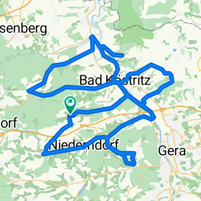
von Töppeln bis Kraftsdorf auf Radweg/Straße
bei Kraftsdorf kurzer steiler Anstieg
restliche Strecke Feld/Waldweg
Kraftsdorf -> Tesseteiche -> Käseschenke -> Töppeln<br />
- -:--
- Duration
- 17.7 km
- Distance
- 194 m
- Ascent
- 194 m
- Descent
- ---
- Avg. speed
- ---
- Avg. speed
Continue with Bikemap
Use, edit, or download this cycling route
You would like to ride Tesseteiche, Käseschenke or customize it for your own trip? Here is what you can do with this Bikemap route:
Free features
- Save this route as favorite or in collections
- Copy & plan your own version of this route
- Sync your route with Garmin or Wahoo
Premium features
Free trial for 3 days, or one-time payment. More about Bikemap Premium.
- Navigate this route on iOS & Android
- Export a GPX / KML file of this route
- Create your custom printout (try it for free)
- Download this route for offline navigation
Discover more Premium features.
Get Bikemap PremiumFrom our community
Other popular routes starting in Hartmannsdorf
 Lutz-Runde Kaltenborn
- Distance
- 16.1 km
- Ascent
- 160 m
- Descent
- 160 m
- Location
- Hartmannsdorf, Free State of Thuringia, Germany
 Buga Lauf
- Distance
- 17 km
- Ascent
- 227 m
- Descent
- 176 m
- Location
- Hartmannsdorf, Free State of Thuringia, Germany
 Burgenroute
- Distance
- 75.5 km
- Ascent
- 518 m
- Descent
- 518 m
- Location
- Hartmannsdorf, Free State of Thuringia, Germany
 Erlbachweg 24, Gera nach Eichenstraße 20, Gera
- Distance
- 10.3 km
- Ascent
- 57 m
- Descent
- 58 m
- Location
- Hartmannsdorf, Free State of Thuringia, Germany
 Am Erlbach 2, Kraftsdorf nach Kaltenborn 24, Kraftsdorf
- Distance
- 5 km
- Ascent
- 92 m
- Descent
- 16 m
- Location
- Hartmannsdorf, Free State of Thuringia, Germany
 Erlbachweg 24, Gera nach Eichenstraße 22, Gera
- Distance
- 10.6 km
- Ascent
- 36 m
- Descent
- 7 m
- Location
- Hartmannsdorf, Free State of Thuringia, Germany
 Rüdersdorf 75, Kraftsdorf nach Rüdersdorf 75, Kraftsdorf
- Distance
- 69.9 km
- Ascent
- 747 m
- Descent
- 750 m
- Location
- Hartmannsdorf, Free State of Thuringia, Germany
 Tesseteiche, Käseschenke
- Distance
- 17.7 km
- Ascent
- 194 m
- Descent
- 194 m
- Location
- Hartmannsdorf, Free State of Thuringia, Germany
Open it in the app