

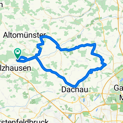
Taxa - Miegersbach - Tremmel - Brugger - Hohenzell - Sixnitgern - Geiselwies - Roßbach - Taxa
A cycling route starting in Odelzhausen, Bavaria, Germany.
Overview
About this route
TEASI track
- -:--
- Duration
- 20.9 km
- Distance
- 64 m
- Ascent
- 66 m
- Descent
- ---
- Avg. speed
- ---
- Avg. speed
Route quality
Waytypes & surfaces along the route
Waytypes
Track
13.3 km
(63 %)
Quiet road
4 km
(19 %)
Surfaces
Paved
4 km
(19 %)
Unpaved
14 km
(67 %)
Gravel
9 km
(43 %)
Asphalt
3.7 km
(18 %)
Continue with Bikemap
Use, edit, or download this cycling route
You would like to ride Taxa - Miegersbach - Tremmel - Brugger - Hohenzell - Sixnitgern - Geiselwies - Roßbach - Taxa or customize it for your own trip? Here is what you can do with this Bikemap route:
Free features
- Save this route as favorite or in collections
- Copy & plan your own version of this route
- Sync your route with Garmin or Wahoo
Premium features
Free trial for 3 days, or one-time payment. More about Bikemap Premium.
- Navigate this route on iOS & Android
- Export a GPX / KML file of this route
- Create your custom printout (try it for free)
- Download this route for offline navigation
Discover more Premium features.
Get Bikemap PremiumFrom our community
Other popular routes starting in Odelzhausen
 Radltour
- Distance
- 36.2 km
- Ascent
- 141 m
- Descent
- 141 m
- Location
- Odelzhausen, Bavaria, Germany
 A8 Ecke
- Distance
- 19.7 km
- Ascent
- 110 m
- Descent
- 98 m
- Location
- Odelzhausen, Bavaria, Germany
 Permanente RTF "Quer durch den Dachauer Landkreis"
- Distance
- 72.9 km
- Ascent
- 324 m
- Descent
- 324 m
- Location
- Odelzhausen, Bavaria, Germany
 Pucher Badesee
- Distance
- 16.5 km
- Ascent
- 63 m
- Descent
- 44 m
- Location
- Odelzhausen, Bavaria, Germany
 Schrobenhausen
- Distance
- 92.1 km
- Ascent
- 315 m
- Descent
- 315 m
- Location
- Odelzhausen, Bavaria, Germany
 Lange Radrunde vom 11. Juni, 12:39
- Distance
- 71 km
- Ascent
- 193 m
- Descent
- 191 m
- Location
- Odelzhausen, Bavaria, Germany
 Gallenbach
- Distance
- 50 km
- Ascent
- 201 m
- Descent
- 201 m
- Location
- Odelzhausen, Bavaria, Germany
 Aufnahme vom 22. Mai, 15:39 bis Akku leer
- Distance
- 44.7 km
- Ascent
- 169 m
- Descent
- 129 m
- Location
- Odelzhausen, Bavaria, Germany
Open it in the app