

Fietsroute van Belgie naar Oostenrijk
A cycling route starting in Bayenthal, North Rhine-Westphalia, Germany.
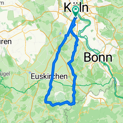
Overview
About this route
Lange afstandsroute langs rivieren fietsend vanaf Belgie doorheen Duitsland tot het Lechtal in oostenrijk
- -:--
- Duration
- 836.2 km
- Distance
- 1,168 m
- Ascent
- 142 m
- Descent
- ---
- Avg. speed
- ---
- Avg. speed
Route quality
Waytypes & surfaces along the route
Waytypes
Quiet road
243.1 km
(29 %)
Path
178.1 km
(21 %)
Surfaces
Paved
687.6 km
(82 %)
Unpaved
49 km
(6 %)
Asphalt
624.4 km
(75 %)
Paving stones
29.1 km
(3 %)
Continue with Bikemap
Use, edit, or download this cycling route
You would like to ride Fietsroute van Belgie naar Oostenrijk or customize it for your own trip? Here is what you can do with this Bikemap route:
Free features
- Save this route as favorite or in collections
- Copy & plan your own version of this route
- Sync your route with Garmin or Wahoo
Premium features
Free trial for 3 days, or one-time payment. More about Bikemap Premium.
- Navigate this route on iOS & Android
- Export a GPX / KML file of this route
- Create your custom printout (try it for free)
- Download this route for offline navigation
Discover more Premium features.
Get Bikemap PremiumFrom our community
Other popular routes starting in Bayenthal
 Bei 30° und Ostwind nach drüben
- Distance
- 55.7 km
- Ascent
- 144 m
- Descent
- 146 m
- Location
- Bayenthal, North Rhine-Westphalia, Germany
 Kurze Sonntagsrunde am Rhein
- Distance
- 13.7 km
- Ascent
- 91 m
- Descent
- 92 m
- Location
- Bayenthal, North Rhine-Westphalia, Germany
 Köln-Ruhrtal und zurück 150 Km
- Distance
- 153.2 km
- Ascent
- 737 m
- Descent
- 724 m
- Location
- Bayenthal, North Rhine-Westphalia, Germany
 Dubi 19_3
- Distance
- 21 km
- Ascent
- 62 m
- Descent
- 60 m
- Location
- Bayenthal, North Rhine-Westphalia, Germany
 So., 12. 06. 2022
- Distance
- 48.1 km
- Ascent
- 315 m
- Descent
- 315 m
- Location
- Bayenthal, North Rhine-Westphalia, Germany
 Hürth- Kalscheuren
- Distance
- 19.9 km
- Ascent
- 51 m
- Descent
- 51 m
- Location
- Bayenthal, North Rhine-Westphalia, Germany
 Köln-Dransdorf-Heimerzheim-Brühl-Köln
- Distance
- 79.6 km
- Ascent
- 252 m
- Descent
- 252 m
- Location
- Bayenthal, North Rhine-Westphalia, Germany
 Eifeltour
- Distance
- 106.9 km
- Ascent
- 687 m
- Descent
- 639 m
- Location
- Bayenthal, North Rhine-Westphalia, Germany
Open it in the app