

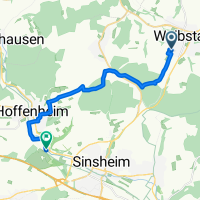
waibstadt - pforzheim
A cycling route starting in Waibstadt, Baden-Württemberg, Germany.
Overview
About this route
:-)
Klasse Sicht über Kraichgau, Felder und Hügel, wenn man nicht wie ich deie ganze Tour im Nebel fährt...- -:--
- Duration
- 73.3 km
- Distance
- 514 m
- Ascent
- 430 m
- Descent
- ---
- Avg. speed
- ---
- Avg. speed

Route quality
Waytypes & surfaces along the route
Waytypes
Track
29.2 km
(40 %)
Quiet road
13.6 km
(19 %)
Surfaces
Paved
59.5 km
(81 %)
Unpaved
4 km
(5 %)
Asphalt
43.7 km
(60 %)
Paved (undefined)
12.3 km
(17 %)
Continue with Bikemap
Use, edit, or download this cycling route
You would like to ride waibstadt - pforzheim or customize it for your own trip? Here is what you can do with this Bikemap route:
Free features
- Save this route as favorite or in collections
- Copy & plan your own version of this route
- Sync your route with Garmin or Wahoo
Premium features
Free trial for 3 days, or one-time payment. More about Bikemap Premium.
- Navigate this route on iOS & Android
- Export a GPX / KML file of this route
- Create your custom printout (try it for free)
- Download this route for offline navigation
Discover more Premium features.
Get Bikemap PremiumFrom our community
Other popular routes starting in Waibstadt
 Brunnen-Tour im Kraichgau-Stromberg
- Distance
- 29.2 km
- Ascent
- 228 m
- Descent
- 228 m
- Location
- Waibstadt, Baden-Württemberg, Germany
 Waibstadt - Bonfeld
- Distance
- 21.2 km
- Ascent
- 214 m
- Descent
- 183 m
- Location
- Waibstadt, Baden-Württemberg, Germany
 Waibstadt - Flinsbach - Helmhof - Adersbach - Waibstadt
- Distance
- 30.9 km
- Ascent
- 285 m
- Descent
- 287 m
- Location
- Waibstadt, Baden-Württemberg, Germany
 Waibstadt - Neckarmühlbach - Obrigheim - Waibstadt
- Distance
- 58.9 km
- Ascent
- 409 m
- Descent
- 407 m
- Location
- Waibstadt, Baden-Württemberg, Germany
 Waibstadt - Guttenbach - Asbach - Waibstadt
- Distance
- 51 km
- Ascent
- 448 m
- Descent
- 449 m
- Location
- Waibstadt, Baden-Württemberg, Germany
 Runde Waibstadt Sinsheim Daisbach Waibstadt
- Distance
- 16.4 km
- Ascent
- 279 m
- Descent
- 250 m
- Location
- Waibstadt, Baden-Württemberg, Germany
 Brunnentour
- Distance
- 29.2 km
- Ascent
- 228 m
- Descent
- 228 m
- Location
- Waibstadt, Baden-Württemberg, Germany
 R&H Tour W/H/S/W
- Distance
- 10.8 km
- Ascent
- 127 m
- Descent
- 177 m
- Location
- Waibstadt, Baden-Württemberg, Germany
Open it in the app