

Oppenau - Rundwanderung zum Buchkopfturm und der Renchtalhütte
A cycling route starting in Bad Peterstal-Griesbach, Baden-Württemberg, Germany.
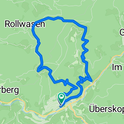
Overview
About this route
Wir beginnen die Wanderung vom Startplatz der Gleitschirmflieger am Rossb&
- -:--
- Duration
- 9.1 km
- Distance
- 407 m
- Ascent
- 390 m
- Descent
- ---
- Avg. speed
- ---
- Avg. speed
Route quality
Waytypes & surfaces along the route
Waytypes
Track
6.2 km
(69 %)
Path
1.2 km
(13 %)
Surfaces
Paved
0.7 km
(8 %)
Unpaved
8 km
(88 %)
Gravel
5.8 km
(64 %)
Ground
1 km
(11 %)
Route highlights
Points of interest along the route
Point of interest after 0.5 km
Kohlgrube
Point of interest after 1.3 km
<p>Der Turm liegt steht auf dem Buchkopf oberhalb des Maisachtals und bietet einen herrlichen Ausblick über das Renchtal und die Rheinebene.</p><p> Der Standort des Buchkopfturms liegt in der Ortschaft Maisach im Stadtwald Oppenau, Distrikt Wernest, oberhalb des Anwesens Bad Antogast im Gewann Buchk
Point of interest after 1.8 km
Wegkreuz Renchtalsteig - Richtung Buchkopfturm
Point of interest after 2 km
Rastmöglichkeit am <b>Renchtalsteig</b> - schöne Aussicht in die Umgebung und auf den <b>Buchkopfturm</b> Oppenau
Point of interest after 2.8 km
Renchtalhütte
Point of interest after 2.9 km
Wiesensteigportal Nähe Renchtalhütte
Point of interest after 4.2 km
Brandbrunnen
Continue with Bikemap
Use, edit, or download this cycling route
You would like to ride Oppenau - Rundwanderung zum Buchkopfturm und der Renchtalhütte or customize it for your own trip? Here is what you can do with this Bikemap route:
Free features
- Save this route as favorite or in collections
- Copy & plan your own version of this route
- Sync your route with Garmin or Wahoo
Premium features
Free trial for 3 days, or one-time payment. More about Bikemap Premium.
- Navigate this route on iOS & Android
- Export a GPX / KML file of this route
- Create your custom printout (try it for free)
- Download this route for offline navigation
Discover more Premium features.
Get Bikemap PremiumFrom our community
Other popular routes starting in Bad Peterstal-Griesbach
 Forsthausstraße 23, Bad Peterstal-Griesbach nach Bahnhofstraße 1, Bad Peterstal-Griesbach
- Distance
- 10.9 km
- Ascent
- 306 m
- Descent
- 435 m
- Location
- Bad Peterstal-Griesbach, Baden-Württemberg, Germany
 Löcherbergwasen - Schloß Staufenberg
- Distance
- 41.4 km
- Ascent
- 416 m
- Descent
- 902 m
- Location
- Bad Peterstal-Griesbach, Baden-Württemberg, Germany
 Bad Peterstal - Kniebis - Bad Peterstal
- Distance
- 42.2 km
- Ascent
- 930 m
- Descent
- 923 m
- Location
- Bad Peterstal-Griesbach, Baden-Württemberg, Germany
 Xing T1 Zuweg Absbachhöhe
- Distance
- 5.6 km
- Ascent
- 539 m
- Descent
- 77 m
- Location
- Bad Peterstal-Griesbach, Baden-Württemberg, Germany
 Schwarzwald 03: Bad Peterstal - Nagold
- Distance
- 83.9 km
- Ascent
- 1,293 m
- Descent
- 1,287 m
- Location
- Bad Peterstal-Griesbach, Baden-Württemberg, Germany
 Löcherberg-Hausach-Löcherberg
- Distance
- 114.5 km
- Ascent
- 1,348 m
- Descent
- 1,348 m
- Location
- Bad Peterstal-Griesbach, Baden-Württemberg, Germany
 Im Nationalpark Schwarzwald
- Distance
- 74.5 km
- Ascent
- 1,178 m
- Descent
- 1,178 m
- Location
- Bad Peterstal-Griesbach, Baden-Württemberg, Germany
 Genießerpfad - Peterstaler Schwarzwaldsteig
- Distance
- 10.9 km
- Ascent
- 528 m
- Descent
- 519 m
- Location
- Bad Peterstal-Griesbach, Baden-Württemberg, Germany
Open it in the app