

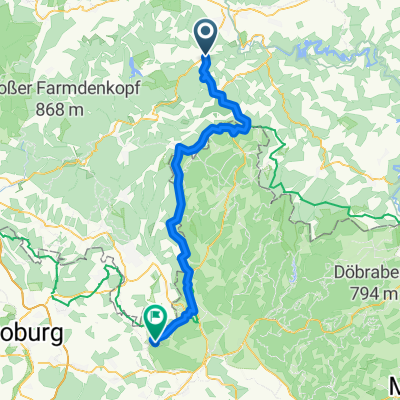
HohenEiche Saalfeld
A cycling route starting in Wittgendorf, Free State of Thuringia, Germany.
Overview
About this route
Wanderung
HohenEiche - Kleingeschwenda Eyba - Saalfeld- -:--
- Duration
- 13.8 km
- Distance
- 65 m
- Ascent
- 509 m
- Descent
- ---
- Avg. speed
- ---
- Avg. speed

Route quality
Waytypes & surfaces along the route
Waytypes
Track
5.4 km
(39 %)
Quiet road
3.7 km
(27 %)
Surfaces
Paved
5.5 km
(40 %)
Unpaved
4.9 km
(35 %)
Asphalt
3.9 km
(28 %)
Gravel
2.9 km
(21 %)
Continue with Bikemap
Use, edit, or download this cycling route
You would like to ride HohenEiche Saalfeld or customize it for your own trip? Here is what you can do with this Bikemap route:
Free features
- Save this route as favorite or in collections
- Copy & plan your own version of this route
- Sync your route with Garmin or Wahoo
Premium features
Free trial for 3 days, or one-time payment. More about Bikemap Premium.
- Navigate this route on iOS & Android
- Export a GPX / KML file of this route
- Create your custom printout (try it for free)
- Download this route for offline navigation
Discover more Premium features.
Get Bikemap PremiumFrom our community
Other popular routes starting in Wittgendorf
 2014-07-20 Hoheneiche-Rohrbach-Doschnitz-Aumühle-Volkmannsdorf-Wickersdorf
- Distance
- 21.2 km
- Ascent
- 504 m
- Descent
- 503 m
- Location
- Wittgendorf, Free State of Thuringia, Germany
 Wickersdorf - Arnstadt
- Distance
- 55.8 km
- Ascent
- 380 m
- Descent
- 745 m
- Location
- Wittgendorf, Free State of Thuringia, Germany
 Tag 4.2 Arnsgereuth nach Mitwitz
- Distance
- 67 km
- Ascent
- 3,119 m
- Descent
- 3,467 m
- Location
- Wittgendorf, Free State of Thuringia, Germany
 HohenEiche Saalfeld
- Distance
- 13.8 km
- Ascent
- 65 m
- Descent
- 509 m
- Location
- Wittgendorf, Free State of Thuringia, Germany
 2014-07-23 Hoheneiche-Grafenthal-Piesau-Lichte-LeipzigerTurm
- Distance
- 51.7 km
- Ascent
- 1,185 m
- Descent
- 1,182 m
- Location
- Wittgendorf, Free State of Thuringia, Germany
 Am Goldberg 1, Saalfeld/Saale nach Winzergasse 7, Jena
- Distance
- 91.6 km
- Ascent
- 9,851 m
- Descent
- 10,248 m
- Location
- Wittgendorf, Free State of Thuringia, Germany
 2014-07-21 Hoheneiche-Rundweg Talsperre Leibnis / Lichte
- Distance
- 39.2 km
- Ascent
- 698 m
- Descent
- 695 m
- Location
- Wittgendorf, Free State of Thuringia, Germany
 Moderate Route
- Distance
- 16.9 km
- Ascent
- 332 m
- Descent
- 349 m
- Location
- Wittgendorf, Free State of Thuringia, Germany
Open it in the app