

Rozhledna Máminka
A cycling route starting in Doksy, Central Bohemia, Czechia.
Overview
About this route
60/40 lesní a polní cesty/silnice. Silnic je na okruhu více, protože je využitá cesta Nižbor - Bratronice která je monentálně pro auta uzavřena (2015), ale i v případě dokončení oprav mostu které ani po roce nezačali tam moc aut nejezdí.
- -:--
- Duration
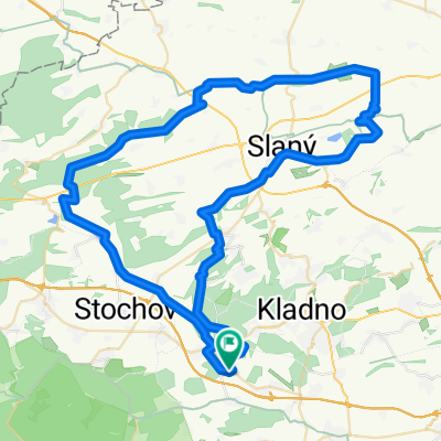
- 80.6 km
- Distance
- 1,071 m
- Ascent
- 1,071 m
- Descent
- ---
- Avg. speed
- ---
- Avg. speed

Route quality
Waytypes & surfaces along the route
Waytypes
Road
34.6 km
(43 %)
Track
30 km
(37 %)
Surfaces
Paved
14.9 km
(19 %)
Unpaved
19.6 km
(24 %)
Gravel
12.9 km
(16 %)
Asphalt
9.5 km
(12 %)
Continue with Bikemap
Use, edit, or download this cycling route
You would like to ride Rozhledna Máminka or customize it for your own trip? Here is what you can do with this Bikemap route:
Free features
- Save this route as favorite or in collections
- Copy & plan your own version of this route
- Sync your route with Garmin or Wahoo
Premium features
Free trial for 3 days, or one-time payment. More about Bikemap Premium.
- Navigate this route on iOS & Android
- Export a GPX / KML file of this route
- Create your custom printout (try it for free)
- Download this route for offline navigation
Discover more Premium features.
Get Bikemap PremiumFrom our community
Other popular routes starting in Doksy
 Vraní skála
- Distance
- 82.6 km
- Ascent
- 971 m
- Descent
- 975 m
- Location
- Doksy, Central Bohemia, Czechia
 Rozhledna Pavlíkov
- Distance
- 79.9 km
- Ascent
- 751 m
- Descent
- 754 m
- Location
- Doksy, Central Bohemia, Czechia
 Okruh Doksy-Unhost-Markuv mlyn-Horni Bezdekov-Doksy
- Distance
- 30 km
- Ascent
- 267 m
- Descent
- 264 m
- Location
- Doksy, Central Bohemia, Czechia
 Vyhlídka Pěnčina
- Distance
- 60.7 km
- Ascent
- 570 m
- Descent
- 570 m
- Location
- Doksy, Central Bohemia, Czechia
 Na Říp po silnici
- Distance
- 96.6 km
- Ascent
- 607 m
- Descent
- 605 m
- Location
- Doksy, Central Bohemia, Czechia
 Amerika
- Distance
- 87.7 km
- Ascent
- 663 m
- Descent
- 663 m
- Location
- Doksy, Central Bohemia, Czechia
 Loušťín - Rakovnický potok - Klíčava
- Distance
- 77.2 km
- Ascent
- 678 m
- Descent
- 678 m
- Location
- Doksy, Central Bohemia, Czechia
 Prozkoumávání Slánska
- Distance
- 70.1 km
- Ascent
- 431 m
- Descent
- 431 m
- Location
- Doksy, Central Bohemia, Czechia
Open it in the app