

von Winterthur: Durch Feld und Wald
A cycling route starting in Winterthur, Canton of Zurich, Switzerland.
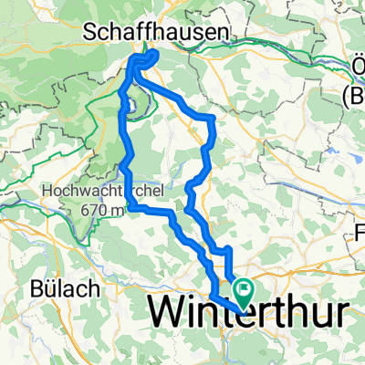
Overview
About this route
Mit dem Bike durch Wald und Feld; vorbei an vielen kleinen vertäumte Waldweihern
Singletrails und Waldwege wechseln sich ab.
Kurze knackige Steigungen sind auch dabei.
(cloned from route 349877)
- -:--
- Duration
- 32.8 km
- Distance
- 351 m
- Ascent
- 351 m
- Descent
- ---
- Avg. speed
- ---
- Avg. speed
Continue with Bikemap
Use, edit, or download this cycling route
You would like to ride von Winterthur: Durch Feld und Wald or customize it for your own trip? Here is what you can do with this Bikemap route:
Free features
- Save this route as favorite or in collections
- Copy & plan your own version of this route
- Sync your route with Garmin or Wahoo
Premium features
Free trial for 3 days, or one-time payment. More about Bikemap Premium.
- Navigate this route on iOS & Android
- Export a GPX / KML file of this route
- Create your custom printout (try it for free)
- Download this route for offline navigation
Discover more Premium features.
Get Bikemap PremiumFrom our community
Other popular routes starting in Winterthur
 Winterthur - Zürich - Zürichsee
- Distance
- 92.8 km
- Ascent
- 365 m
- Descent
- 365 m
- Location
- Winterthur, Canton of Zurich, Switzerland
 Wülflingerstrasse 3, Winterthur to Aeussere Zelglistrasse 19, Pfäffikon
- Distance
- 20.6 km
- Ascent
- 246 m
- Descent
- 131 m
- Location
- Winterthur, Canton of Zurich, Switzerland
 Bachtelstrasse 5, Winterthur nach Bachtelstrasse 25, Winterthur
- Distance
- 22.2 km
- Ascent
- 278 m
- Descent
- 285 m
- Location
- Winterthur, Canton of Zurich, Switzerland
 Schützenstrasse 81, Winterthur nach Bachtelstrasse 23, Winterthur
- Distance
- 23.6 km
- Ascent
- 417 m
- Descent
- 419 m
- Location
- Winterthur, Canton of Zurich, Switzerland
 Bachtelstrasse 23, Winterthur nach 3 Eichen 9, Rüti ZH
- Distance
- 36.2 km
- Ascent
- 1,709 m
- Descent
- 1,674 m
- Location
- Winterthur, Canton of Zurich, Switzerland
 Bachtelstrasse 15–19, Winterthur nach Tösswisweg, Wildberg
- Distance
- 16.4 km
- Ascent
- 205 m
- Descent
- 104 m
- Location
- Winterthur, Canton of Zurich, Switzerland
 Winterthur - Mülligen
- Distance
- 76.4 km
- Ascent
- 290 m
- Descent
- 371 m
- Location
- Winterthur, Canton of Zurich, Switzerland
 Rheinau-Rheinfall
- Distance
- 59.1 km
- Ascent
- 427 m
- Descent
- 427 m
- Location
- Winterthur, Canton of Zurich, Switzerland
Open it in the app