

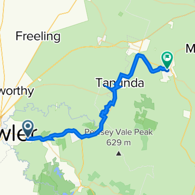
Gawler to Kapunda (no major roads)
A cycling route starting in Gawler, South Australia, Australia.
Overview
About this route
- -:--
- Duration
- 41.9 km
- Distance
- 229 m
- Ascent
- 67 m
- Descent
- ---
- Avg. speed
- 242 m
- Max. altitude
Route quality
Waytypes & surfaces along the route
Waytypes
Quiet road
28 km
(67 %)
Track
8.8 km
(21 %)
Surfaces
Paved
8 km
(19 %)
Unpaved
32.2 km
(77 %)
Unpaved (undefined)
32.2 km
(77 %)
Asphalt
7.5 km
(18 %)
Route highlights
Points of interest along the route
Point of interest after 23 km
This track is a bit overgrown so be careful.
Point of interest after 36.3 km
This section of road can flood after heavy rain however it is still easy to walk across as long as you dont mind getting your socks wet. Take a change of socks :)
Continue with Bikemap
Use, edit, or download this cycling route
You would like to ride Gawler to Kapunda (no major roads) or customize it for your own trip? Here is what you can do with this Bikemap route:
Free features
- Save this route as favorite or in collections
- Copy & plan your own version of this route
- Sync your route with Garmin or Wahoo
Premium features
Free trial for 3 days, or one-time payment. More about Bikemap Premium.
- Navigate this route on iOS & Android
- Export a GPX / KML file of this route
- Create your custom printout (try it for free)
- Download this route for offline navigation
Discover more Premium features.
Get Bikemap PremiumFrom our community
Other popular routes starting in Gawler
 Barossa Trail
- Distance
- 39.1 km
- Ascent
- 368 m
- Descent
- 151 m
- Location
- Gawler, South Australia, Australia
 Repeat HF Hills inc. Para Wirra CP
- Distance
- 73.8 km
- Ascent
- 854 m
- Descent
- 854 m
- Location
- Gawler, South Australia, Australia
 Gawler - Port Elliot loop 2012
- Distance
- 293.5 km
- Ascent
- 1,139 m
- Descent
- 1,139 m
- Location
- Gawler, South Australia, Australia
 Gawler (South Australia) circuit
- Distance
- 11.5 km
- Ascent
- 98 m
- Descent
- 96 m
- Location
- Gawler, South Australia, Australia
 Gawler to Tanunda to Angaston via Barossa Trail
- Distance
- 44.2 km
- Ascent
- 460 m
- Descent
- 174 m
- Location
- Gawler, South Australia, Australia
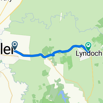 Sunnydale Ave, Gawler East to Barossa Valley Way, Lyndoch
- Distance
- 11.9 km
- Ascent
- 116 m
- Descent
- 38 m
- Location
- Gawler, South Australia, Australia
 Brett GW Route 1
- Distance
- 68.3 km
- Ascent
- 299 m
- Descent
- 299 m
- Location
- Gawler, South Australia, Australia
 Gawler to Munno Para Wetlands
- Distance
- 14.3 km
- Ascent
- 43 m
- Descent
- 63 m
- Location
- Gawler, South Australia, Australia
Open it in the app