

Chermside
A cycling route starting in Wavell Heights, Queensland, Australia.
Overview
About this route
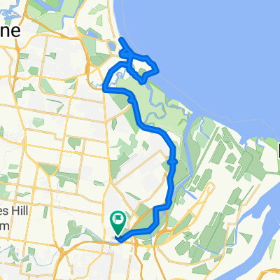
Chermside Route
- -:--
- Duration
- 66.6 km
- Distance
- 167 m
- Ascent
- 172 m
- Descent
- ---
- Avg. speed
- ---
- Avg. speed
Route quality
Waytypes & surfaces along the route
Waytypes
Cycleway
29.5 km
(44 %)
Busy road
13.2 km
(20 %)
Surfaces
Paved
52.9 km
(79 %)
Asphalt
34.6 km
(52 %)
Concrete
15.5 km
(23 %)
Continue with Bikemap
Use, edit, or download this cycling route
You would like to ride Chermside or customize it for your own trip? Here is what you can do with this Bikemap route:
Free features
- Save this route as favorite or in collections
- Copy & plan your own version of this route
- Sync your route with Garmin or Wahoo
Premium features
Free trial for 3 days, or one-time payment. More about Bikemap Premium.
- Navigate this route on iOS & Android
- Export a GPX / KML file of this route
- Create your custom printout (try it for free)
- Download this route for offline navigation
Discover more Premium features.
Get Bikemap PremiumFrom our community
Other popular routes starting in Wavell Heights
 The Toombul to Boondall Spoonful
- Distance
- 27.3 km
- Ascent
- 75 m
- Descent
- 75 m
- Location
- Wavell Heights, Queensland, Australia
 Fernvale Loop
- Distance
- 166 km
- Ascent
- 2,705 m
- Descent
- 2,709 m
- Location
- Wavell Heights, Queensland, Australia
 Puruse Nundah, Goat Track, Nebo
- Distance
- 75.1 km
- Ascent
- 885 m
- Descent
- 885 m
- Location
- Wavell Heights, Queensland, Australia
 Lady Cilento Hospital via Roma St Parklands
- Distance
- 14.8 km
- Ascent
- 132 m
- Descent
- 141 m
- Location
- Wavell Heights, Queensland, Australia
 North BNE alternative routes
- Distance
- 19 km
- Ascent
- 37 m
- Descent
- 40 m
- Location
- Wavell Heights, Queensland, Australia
 99 bikes bowen hills route !
- Distance
- 32.7 km
- Ascent
- 218 m
- Descent
- 218 m
- Location
- Wavell Heights, Queensland, Australia
 Nundah to Sandgate Foreshore
- Distance
- 39.7 km
- Ascent
- 123 m
- Descent
- 123 m
- Location
- Wavell Heights, Queensland, Australia
 Kalinga Boondall curcuit
- Distance
- 27.7 km
- Ascent
- 78 m
- Descent
- 87 m
- Location
- Wavell Heights, Queensland, Australia
Open it in the app