

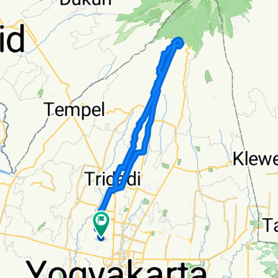
Yogyakarta-Borobudur - DKI
A cycling route starting in Yogyakarta, Special Region of Yogyakarta, Indonesia.
Overview
About this route
fietstochtje
- -:--
- Duration
- 37.9 km
- Distance
- 218 m
- Ascent
- 67 m
- Descent
- ---
- Avg. speed
- ---
- Avg. speed
Route quality
Waytypes & surfaces along the route
Waytypes
Quiet road
21.5 km
(57 %)
Road
10.7 km
(28 %)
Surfaces
Paved
27.1 km
(71 %)
Unpaved
0.9 km
(2 %)
Asphalt
24.4 km
(64 %)
Concrete
1.5 km
(4 %)
Continue with Bikemap
Use, edit, or download this cycling route
You would like to ride Yogyakarta-Borobudur - DKI or customize it for your own trip? Here is what you can do with this Bikemap route:
Free features
- Save this route as favorite or in collections
- Copy & plan your own version of this route
- Sync your route with Garmin or Wahoo
Premium features
Free trial for 3 days, or one-time payment. More about Bikemap Premium.
- Navigate this route on iOS & Android
- Export a GPX / KML file of this route
- Create your custom printout (try it for free)
- Download this route for offline navigation
Discover more Premium features.
Get Bikemap PremiumFrom our community
Other popular routes starting in Yogyakarta
 Moderate route in Kecamatan Kasihan
- Distance
- 46.6 km
- Ascent
- 527 m
- Descent
- 530 m
- Location
- Yogyakarta, Special Region of Yogyakarta, Indonesia
 bendungan Kamijoro
- Distance
- 51.4 km
- Ascent
- 1,173 m
- Descent
- 1,122 m
- Location
- Yogyakarta, Special Region of Yogyakarta, Indonesia
 Kotagede to Imogiri
- Distance
- 21.6 km
- Ascent
- 101 m
- Descent
- 171 m
- Location
- Yogyakarta, Special Region of Yogyakarta, Indonesia
 Kali Gathux Ride
- Distance
- 35.2 km
- Ascent
- 544 m
- Descent
- 567 m
- Location
- Yogyakarta, Special Region of Yogyakarta, Indonesia
 Jalan Jambon, Kecamatan Gamping to Jalan Baturan Raya 3, Kecamatan Gamping
- Distance
- 49.6 km
- Ascent
- 417 m
- Descent
- 439 m
- Location
- Yogyakarta, Special Region of Yogyakarta, Indonesia
 Gang Menur 4b, Kecamatan Umbulharjo to Tahunan, Umbulharjo
- Distance
- 18.2 km
- Ascent
- 167 m
- Descent
- 186 m
- Location
- Yogyakarta, Special Region of Yogyakarta, Indonesia
 Jalan Baturan Raya 3, Kecamatan Gamping to Jalan Baturan Raya 3, Kecamatan Gamping
- Distance
- 48.7 km
- Ascent
- 1,428 m
- Descent
- 1,447 m
- Location
- Yogyakarta, Special Region of Yogyakarta, Indonesia
 Jalan Sidomulyo 356, Kecamatan Tegalrejo to Jalan Sidomulyo 356, Kecamatan Tegalrejo
- Distance
- 41.3 km
- Ascent
- 167 m
- Descent
- 172 m
- Location
- Yogyakarta, Special Region of Yogyakarta, Indonesia
Open it in the app