

1a Etappe: Route des Grandes Alpes
A cycling route starting in Martigny-Ville, Valais, Switzerland.
Overview
About this route
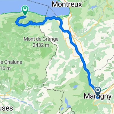
Start: Martigny
Finish: Aosta Pässe: Col de Champex, Grosser St. Bernhard- -:--
- Duration
- 92.6 km
- Distance
- 2,646 m
- Ascent
- 2,531 m
- Descent
- ---
- Avg. speed
- ---
- Avg. speed
Route quality
Waytypes & surfaces along the route
Waytypes
Busy road
45.3 km
(49 %)
Road
29.4 km
(32 %)
Surfaces
Paved
58.1 km
(63 %)
Unpaved
0.3 km
(<1 %)
Asphalt
57.6 km
(62 %)
Paving stones
0.5 km
(<1 %)
Continue with Bikemap
Use, edit, or download this cycling route
You would like to ride 1a Etappe: Route des Grandes Alpes or customize it for your own trip? Here is what you can do with this Bikemap route:
Free features
- Save this route as favorite or in collections
- Copy & plan your own version of this route
- Sync your route with Garmin or Wahoo
Premium features
Free trial for 3 days, or one-time payment. More about Bikemap Premium.
- Navigate this route on iOS & Android
- Export a GPX / KML file of this route
- Create your custom printout (try it for free)
- Download this route for offline navigation
Discover more Premium features.
Get Bikemap PremiumFrom our community
Other popular routes starting in Martigny-Ville
 Jumelage 2015, étape 1
- Distance
- 127.6 km
- Ascent
- 1,987 m
- Descent
- 2,149 m
- Location
- Martigny-Ville, Valais, Switzerland
 Etape 4 : Martigny - Station de Verbier (Tour de Suisse, Aramis) 40 km
- Distance
- 40.5 km
- Ascent
- 2,293 m
- Descent
- 653 m
- Location
- Martigny-Ville, Valais, Switzerland
 Forclaz backroad - Champex Lac - Col des Planches / Col du Lein
- Distance
- 102 km
- Ascent
- 3,119 m
- Descent
- 3,118 m
- Location
- Martigny-Ville, Valais, Switzerland
 Martigny nach Oberwald
- Distance
- 138.3 km
- Ascent
- 2,322 m
- Descent
- 1,411 m
- Location
- Martigny-Ville, Valais, Switzerland
 Alpencross 2007/1 - Martigny/CH bis Aosta/I
- Distance
- 89.2 km
- Ascent
- 2,705 m
- Descent
- 2,584 m
- Location
- Martigny-Ville, Valais, Switzerland
 VR04 Martigny-St Gingolph.kml - VR04 Martigny-St Gingolph.kml_VR04 Martigny-St Gingolph
- Distance
- 60.4 km
- Ascent
- 408 m
- Descent
- 484 m
- Location
- Martigny-Ville, Valais, Switzerland
![[Martigny_000] Col de la Croix de Cœur.](https://media.bikemap.net/routes/7803337/staticmaps/in_cdd017ee-75fd-46e2-a0ec-c59e19bcda56_400x400_bikemap-2021-3D-static.png) [Martigny_000] Col de la Croix de Cœur.
[Martigny_000] Col de la Croix de Cœur.- Distance
- 69.2 km
- Ascent
- 1,694 m
- Descent
- 1,695 m
- Location
- Martigny-Ville, Valais, Switzerland
 Martigny-Thollon
- Distance
- 69.9 km
- Ascent
- 1,891 m
- Descent
- 1,444 m
- Location
- Martigny-Ville, Valais, Switzerland
Open it in the app