

21Dec2015
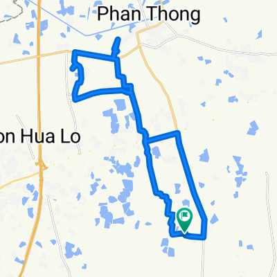
A cycling route starting in Ban Bueng, Changwat Chon Buri, Thailand.
Overview
About this route
12/21/2558 BE, 18:19
- 44 min
- Duration
- 13.1 km
- Distance
- 22 m
- Ascent
- 20 m
- Descent
- 17.9 km/h
- Avg. speed
- ---
- Avg. speed
Route quality
Waytypes & surfaces along the route
Waytypes
Quiet road
10.3 km
(78 %)
Road
1 km
(7 %)
Surfaces
Unpaved
1 km
(7 %)
Unpaved (undefined)
1 km
(7 %)
Undefined
12.2 km
(93 %)
Continue with Bikemap
Use, edit, or download this cycling route
You would like to ride 21Dec2015 or customize it for your own trip? Here is what you can do with this Bikemap route:
Free features
- Save this route as favorite or in collections
- Copy & plan your own version of this route
- Sync your route with Garmin or Wahoo
Premium features
Free trial for 3 days, or one-time payment. More about Bikemap Premium.
- Navigate this route on iOS & Android
- Export a GPX / KML file of this route
- Create your custom printout (try it for free)
- Download this route for offline navigation
Discover more Premium features.
Get Bikemap PremiumFrom our community
Other popular routes starting in Ban Bueng
 Namtok Chan Ta Then Waterfall, Tambon Bang Phra to Namtok Chan Ta Then Waterfall, Tambon Bang Phra
- Distance
- 2.3 km
- Ascent
- 116 m
- Descent
- 67 m
- Location
- Ban Bueng, Changwat Chon Buri, Thailand
 輕鬆騎行 อ.บ้านบึง
- Distance
- 0.9 km
- Ascent
- 3 m
- Descent
- 4 m
- Location
- Ban Bueng, Changwat Chon Buri, Thailand
 Relaxed route in Amphoe Ban Bueng
- Distance
- 28.4 km
- Ascent
- 296 m
- Descent
- 295 m
- Location
- Ban Bueng, Changwat Chon Buri, Thailand
 J084 – Jeudi 30 mars 2017 Ban Bueng – Ban Tin Pet (intersection routes 365 – 315 – 304)
- Distance
- 48.1 km
- Ascent
- 10 m
- Descent
- 75 m
- Location
- Ban Bueng, Changwat Chon Buri, Thailand
 344 98/9, Tambon Nong Samsak to Soi Amphawan, Tambon Nong Ri
- Distance
- 6.9 km
- Ascent
- 64 m
- Descent
- 27 m
- Location
- Ban Bueng, Changwat Chon Buri, Thailand
 Steady ride in Pathum Rat
- Distance
- 32.2 km
- Ascent
- 183 m
- Descent
- 183 m
- Location
- Ban Bueng, Changwat Chon Buri, Thailand
 Recovered Route
- Distance
- 33.9 km
- Ascent
- 46 m
- Descent
- 45 m
- Location
- Ban Bueng, Changwat Chon Buri, Thailand
 05-01-2016
- Distance
- 12.4 km
- Ascent
- 22 m
- Descent
- 21 m
- Location
- Ban Bueng, Changwat Chon Buri, Thailand
Open it in the app