

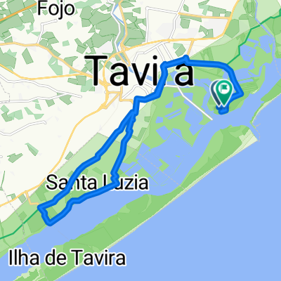
#01 Tavira - Nível 1
A cycling route starting in Tavira Municipality, Faro, Portugal.
Overview
About this route
O património natural e religioso do Sotavento está na rota dos ciclistas que optem por este percurso. A ria Formosa faz parte da paisagem alcançada desde Cacela Velha, onde o casario tradicional algarvio partilha atenções com a igreja renascentista e com o forte. O traçado leva-nos às localidades de veraneio de Manta Rota e de Altura. Por uma estrada com bom piso e pouco tráfego sobe-se ao campo de golfe de Monte Rei, que antecede a passagem por Curral de Boeiros.
Na descida para o vale da Asseca com passagem junto ao Pego do Inferno para depois subirmos para Santo Estevão, uma aldeia típica do Sotavento Algarvio.
- -:--
- Duration
- 72.2 km
- Distance
- 860 m
- Ascent
- 860 m
- Descent
- ---
- Avg. speed
- 166 m
- Avg. speed

Route quality
Waytypes & surfaces along the route
Waytypes
Road
42.4 km
(59 %)
Busy road
15.5 km
(21 %)
Surfaces
Paved
49.1 km
(68 %)
Asphalt
48.8 km
(68 %)
Paved (undefined)
0.4 km
(<1 %)
Undefined
23.1 km
(32 %)
Continue with Bikemap
Use, edit, or download this cycling route
You would like to ride #01 Tavira - Nível 1 or customize it for your own trip? Here is what you can do with this Bikemap route:
Free features
- Save this route as favorite or in collections
- Copy & plan your own version of this route
- Sync your route with Garmin or Wahoo
Premium features
Free trial for 3 days, or one-time payment. More about Bikemap Premium.
- Navigate this route on iOS & Android
- Export a GPX / KML file of this route
- Create your custom printout (try it for free)
- Download this route for offline navigation
Discover more Premium features.
Get Bikemap PremiumFrom our community
Other popular routes starting in Tavira Municipality
 West of Tavira
- Distance
- 18.6 km
- Ascent
- 67 m
- Descent
- 67 m
- Location
- Tavira Municipality, Faro, Portugal
 Tavira
- Distance
- 64.4 km
- Ascent
- 676 m
- Descent
- 653 m
- Location
- Tavira Municipality, Faro, Portugal
 Spain trip Feb 3 w Naomi :) Estrada da mata
- Distance
- 30.5 km
- Ascent
- 196 m
- Descent
- 192 m
- Location
- Tavira Municipality, Faro, Portugal
 Tavira - Quatro Águas
- Distance
- 2.3 km
- Ascent
- 61 m
- Descent
- 62 m
- Location
- Tavira Municipality, Faro, Portugal
 Sunday Ride with some water
- Distance
- 33 km
- Ascent
- 702 m
- Descent
- 691 m
- Location
- Tavira Municipality, Faro, Portugal
 PWT-2017_E04: Tavira - Faro
- Distance
- 43 km
- Ascent
- 81 m
- Descent
- 104 m
- Location
- Tavira Municipality, Faro, Portugal
 TPB v0.5 Cabanas de Tavira, Algarve, Portugal
- Distance
- 32.6 km
- Ascent
- 348 m
- Descent
- 348 m
- Location
- Tavira Municipality, Faro, Portugal
 TAV_EiraPalma_SantaRita_TAV
- Distance
- 32.2 km
- Ascent
- 302 m
- Descent
- 304 m
- Location
- Tavira Municipality, Faro, Portugal
Open it in the app