

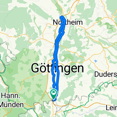
Friedland - Werraradweg
A cycling route starting in Gemeinde Friedland, Lower Saxony, Germany.
Overview
About this route
Verbindung vom Leineradweg zum Werraradweg
(cloned from route 3290336)- -:--
- Duration
- 14.1 km
- Distance
- 130 m
- Ascent
- 172 m
- Descent
- ---
- Avg. speed
- ---
- Avg. speed
Route quality
Waytypes & surfaces along the route
Waytypes
Track
4.4 km
(32 %)
Road
3.8 km
(27 %)
Surfaces
Paved
14.1 km
(100 %)
Asphalt
12.1 km
(86 %)
Concrete
1.5 km
(10 %)
Continue with Bikemap
Use, edit, or download this cycling route
You would like to ride Friedland - Werraradweg or customize it for your own trip? Here is what you can do with this Bikemap route:
Free features
- Save this route as favorite or in collections
- Copy & plan your own version of this route
- Sync your route with Garmin or Wahoo
Premium features
Free trial for 3 days, or one-time payment. More about Bikemap Premium.
- Navigate this route on iOS & Android
- Export a GPX / KML file of this route
- Create your custom printout (try it for free)
- Download this route for offline navigation
Discover more Premium features.
Get Bikemap PremiumFrom our community
Other popular routes starting in Gemeinde Friedland
 Leine-Werra Verbindung
- Distance
- 13.6 km
- Ascent
- 127 m
- Descent
- 170 m
- Location
- Gemeinde Friedland, Lower Saxony, Germany
 Friedland - Werraradweg
- Distance
- 14.1 km
- Ascent
- 130 m
- Descent
- 172 m
- Location
- Gemeinde Friedland, Lower Saxony, Germany
 Friedland- Frankenberg
- Distance
- 126.2 km
- Ascent
- 1,080 m
- Descent
- 992 m
- Location
- Gemeinde Friedland, Lower Saxony, Germany
 Groß Schneen 34,5km MTB--Tour
- Distance
- 35.1 km
- Ascent
- 646 m
- Descent
- 646 m
- Location
- Gemeinde Friedland, Lower Saxony, Germany
 Solling-Tour- Bad Karlshafeb
- Distance
- 148.2 km
- Ascent
- 1,052 m
- Descent
- 1,052 m
- Location
- Gemeinde Friedland, Lower Saxony, Germany
 Habichtsstein
- Distance
- 61.8 km
- Ascent
- 763 m
- Descent
- 763 m
- Location
- Gemeinde Friedland, Lower Saxony, Germany
 Friedland - NOM Hafen
- Distance
- 82.1 km
- Ascent
- 138 m
- Descent
- 137 m
- Location
- Gemeinde Friedland, Lower Saxony, Germany
 Burg Hanstein-Schloß Berlepsch 44,6 km
- Distance
- 44.7 km
- Ascent
- 676 m
- Descent
- 676 m
- Location
- Gemeinde Friedland, Lower Saxony, Germany
Open it in the app