

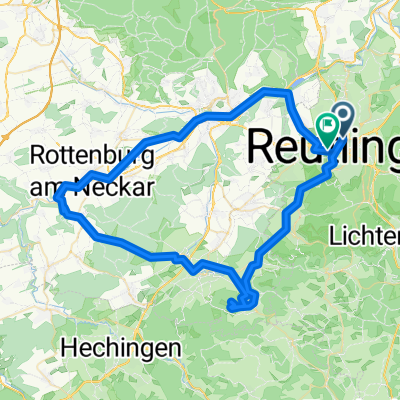
20151219_120750.gpx
A cycling route starting in Reutlingen, Baden-Württemberg, Germany.
Overview
About this route
TEASI track
- -:--
- Duration
- 30.7 km
- Distance
- 339 m
- Ascent
- 339 m
- Descent
- ---
- Avg. speed
- ---
- Avg. speed
Route quality
Waytypes & surfaces along the route
Waytypes
Quiet road
9.9 km
(32 %)
Track
8.5 km
(28 %)
Surfaces
Paved
28.7 km
(94 %)
Unpaved
0.3 km
(<1 %)
Asphalt
26.2 km
(85 %)
Paved (undefined)
1.9 km
(6 %)
Continue with Bikemap
Use, edit, or download this cycling route
You would like to ride 20151219_120750.gpx or customize it for your own trip? Here is what you can do with this Bikemap route:
Free features
- Save this route as favorite or in collections
- Copy & plan your own version of this route
- Sync your route with Garmin or Wahoo
Premium features
Free trial for 3 days, or one-time payment. More about Bikemap Premium.
- Navigate this route on iOS & Android
- Export a GPX / KML file of this route
- Create your custom printout (try it for free)
- Download this route for offline navigation
Discover more Premium features.
Get Bikemap PremiumFrom our community
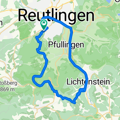
Other popular routes starting in Reutlingen
 Albtour
- Distance
- 107.2 km
- Ascent
- 947 m
- Descent
- 950 m
- Location
- Reutlingen, Baden-Württemberg, Germany
 Reutlingen - Lindenhof - Holzelfingen - Reutlingen
- Distance
- 32.2 km
- Ascent
- 408 m
- Descent
- 408 m
- Location
- Reutlingen, Baden-Württemberg, Germany
 E-roller ausflug option 2
- Distance
- 76.5 km
- Ascent
- 1,141 m
- Descent
- 1,135 m
- Location
- Reutlingen, Baden-Württemberg, Germany
 Neckartal - Tübingen - Reutlingen
- Distance
- 32.2 km
- Ascent
- 203 m
- Descent
- 214 m
- Location
- Reutlingen, Baden-Württemberg, Germany
 Reutlingen - Pfullinger Berg - Genkingen
- Distance
- 16.5 km
- Ascent
- 541 m
- Descent
- 142 m
- Location
- Reutlingen, Baden-Württemberg, Germany
 Rund um betzingenoerdelerstraße 53, Reutlingen nach Goerdelerstraße 53, Reutlingen
- Distance
- 41 km
- Ascent
- 573 m
- Descent
- 575 m
- Location
- Reutlingen, Baden-Württemberg, Germany
 Reutlingen-Nebelhöhle
- Distance
- 29.1 km
- Ascent
- 534 m
- Descent
- 534 m
- Location
- Reutlingen, Baden-Württemberg, Germany
 RT-Metzingen-Neuffen-Urach-Eningen-RT
- Distance
- 63.8 km
- Ascent
- 1,378 m
- Descent
- 1,216 m
- Location
- Reutlingen, Baden-Württemberg, Germany
Open it in the app