

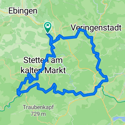
Straßberg - Burladingen - Onstmettingen
A cycling route starting in Straßberg, Baden-Württemberg, Germany.
Overview
About this route
Leichte Strecke mit wenig Steigungen, teilweise auf der Strecke des Albstadt-Bike-Marathon
- -:--
- Duration
- 68.9 km
- Distance
- 1,272 m
- Ascent
- 1,145 m
- Descent
- ---
- Avg. speed
- 940 m
- Avg. speed
Route quality
Waytypes & surfaces along the route
Waytypes
Track
35.5 km
(51 %)
Quiet road
15.7 km
(23 %)
Surfaces
Paved
30.4 km
(44 %)
Unpaved
27.4 km
(40 %)
Gravel
21.9 km
(32 %)
Asphalt
20.3 km
(30 %)
Continue with Bikemap
Use, edit, or download this cycling route
You would like to ride Straßberg - Burladingen - Onstmettingen or customize it for your own trip? Here is what you can do with this Bikemap route:
Free features
- Save this route as favorite or in collections
- Copy & plan your own version of this route
- Sync your route with Garmin or Wahoo
Premium features
Free trial for 3 days, or one-time payment. More about Bikemap Premium.
- Navigate this route on iOS & Android
- Export a GPX / KML file of this route
- Create your custom printout (try it for free)
- Download this route for offline navigation
Discover more Premium features.
Get Bikemap PremiumFrom our community
Other popular routes starting in Straßberg
 Samstagnachmittag -Tour
- Distance
- 33.5 km
- Ascent
- 462 m
- Descent
- 462 m
- Location
- Straßberg, Baden-Württemberg, Germany
 08-01-25 kleine Runde
- Distance
- 25.7 km
- Ascent
- 413 m
- Descent
- 416 m
- Location
- Straßberg, Baden-Württemberg, Germany
 Rundtour Straßberg-Fehlatahl-Bütnautal-Straßberg
- Distance
- 60.1 km
- Ascent
- 639 m
- Descent
- 639 m
- Location
- Straßberg, Baden-Württemberg, Germany
 Herbstausfahrt über die Fürstenhöhe ins Donautal
- Distance
- 68.7 km
- Ascent
- 634 m
- Descent
- 621 m
- Location
- Straßberg, Baden-Württemberg, Germany
 Straßberg - Laucherttal - Donautal - Werenwag - Stetten a.k.M.
- Distance
- 76 km
- Ascent
- 1,365 m
- Descent
- 1,286 m
- Location
- Straßberg, Baden-Württemberg, Germany
 Durchs obere Schmeiental
- Distance
- 36 km
- Ascent
- 416 m
- Descent
- 416 m
- Location
- Straßberg, Baden-Württemberg, Germany
 Rundtour Straßberg-Fehlatahl-Bütnautal-Straßberg CLONED FROM ROUTE 1634577
- Distance
- 60.1 km
- Ascent
- 646 m
- Descent
- 646 m
- Location
- Straßberg, Baden-Württemberg, Germany
 Straßberg - Sigmaringen und zurück CLONED FROM ROUTE 33537
- Distance
- 51.2 km
- Ascent
- 514 m
- Descent
- 514 m
- Location
- Straßberg, Baden-Württemberg, Germany
Open it in the app