

Bike Crossing Germany Tag 6
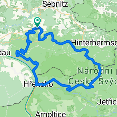
A cycling route starting in Sebnitz, Saxony, Germany.
Overview
About this route
Offroad von Kap Arkona zum Dreiländereck bei Hof in 8 Tagen. Die Strecke wurde im September 2015 gefahren.
Nicht zu empfehlen ist der Abstieg durch den Wolfsgraben von Ostrau nach Postelwitz wegen der vielen Treppen. Gleich hinter der tschechischen Grenze in Tisa lässt sich gut Mittag essen.- -:--
- Duration
- 79 km
- Distance
- 1,053 m
- Ascent
- 664 m
- Descent
- ---
- Avg. speed
- ---
- Avg. speed
Route quality
Waytypes & surfaces along the route
Waytypes
Track
40.5 km
(51 %)
Road
13.9 km
(18 %)
Surfaces
Paved
37.2 km
(47 %)
Unpaved
39 km
(49 %)
Asphalt
36.5 km
(46 %)
Gravel
19 km
(24 %)
Continue with Bikemap
Use, edit, or download this cycling route
You would like to ride Bike Crossing Germany Tag 6 or customize it for your own trip? Here is what you can do with this Bikemap route:
Free features
- Save this route as favorite or in collections
- Copy & plan your own version of this route
- Sync your route with Garmin or Wahoo
Premium features
Free trial for 3 days, or one-time payment. More about Bikemap Premium.
- Navigate this route on iOS & Android
- Export a GPX / KML file of this route
- Create your custom printout (try it for free)
- Download this route for offline navigation
Discover more Premium features.
Get Bikemap PremiumFrom our community
Other popular routes starting in Sebnitz
 Sächsische-Böhmische-Schweiz - Runde
- Distance
- 42.5 km
- Ascent
- 394 m
- Descent
- 394 m
- Location
- Sebnitz, Saxony, Germany
 Lehmhübelweg, Sebnitz nach Bad Schandau, Bad Schandau
- Distance
- 21.3 km
- Ascent
- 349 m
- Descent
- 616 m
- Location
- Sebnitz, Saxony, Germany
 Kleines Prebischtor, Var. 2
- Distance
- 46.8 km
- Ascent
- 586 m
- Descent
- 586 m
- Location
- Sebnitz, Saxony, Germany
 Gipfeltour, hart aber schön
- Distance
- 106 km
- Ascent
- 1,851 m
- Descent
- 1,851 m
- Location
- Sebnitz, Saxony, Germany
 110 km Sparkassen Panorama- RADtour
- Distance
- 101.1 km
- Ascent
- 1,097 m
- Descent
- 1,097 m
- Location
- Sebnitz, Saxony, Germany
 Zwischen Kirnitzschtal und Balzhütten
- Distance
- 38 km
- Ascent
- 415 m
- Descent
- 415 m
- Location
- Sebnitz, Saxony, Germany
 Zeughaus, Zeidlertal, Tanzplan
- Distance
- 46.2 km
- Ascent
- 696 m
- Descent
- 697 m
- Location
- Sebnitz, Saxony, Germany
 Grenzerfahrung III - Unvollständig
- Distance
- 51.7 km
- Ascent
- 803 m
- Descent
- 800 m
- Location
- Sebnitz, Saxony, Germany
Open it in the app